
Everest Region: Trekking Map
Everest Region: Trekking Map
Map
Couldn't load pickup availability
Join our rewards scheme and earn reward points on this purchase!
Earn points on this!
Sign in or Sign up!- Release Date: 01/06/2009
- Barcode: 9788190327060
- Genre: Science Nature & Math
- Sub-Genre: Atlases & Maps
Everest Region: Trekking Map
Couldn't load pickup availability
Collapsible content
DESCRIPTION
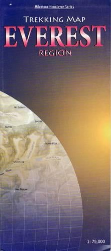
Detailed, easy-to-read fold-out map showing all major trails. Contour-coloured so that users can visualise the lay of the land, picturing mountain ranges and other relief features with ease. The map covers the Everest and Gokyo regions and beyond,from Lukla all the way to the Rongbuk Glacier in Tibet and as far as Mt Makalu in the east. Shown in detail are the trails to RenjoLa Pass, Mera Peak, and Island Peak and through AmphuLapcheLa Pass and the Hongu valley. Most major settlements and campsites shown on the trails, as also peaks, are marked along with their altitudes, in both metres and feet.
DELIVERY & RETURNS
UK Delivery:
- Free delivery on all orders of £10 or more.
- £1.49 delivery fee on orders below £10.
- UK orders are shipped via Royal Mail 2nd Class.
International Delivery:
- Flat rate delivery charges vary by country.
Dispatch and Delivery Times:
- All orders are shipped from our warehouse in Northampton, UK within 48 hours of receipt during working hours.
- UK mainland orders typically arrive within 3-5 working days via Royal Mail 2nd Class.
- International estimated delivery times:
- Europe & Channel Islands: 7 to 10 working days
- USA: 7 to 15 working days
- Rest of the World: 9 to 21 working days
View our full delivery infomation here.
-
OVER
2 MILLION PRODUCTS
-
60 MILLION CUSTOMERS
ACROSS 190 COUNTRIES
You might also like
Loading recommendations...