
Pfälzer Höhenweg
Pfälzer Höhenweg
Map
Couldn't load pickup availability
Join our rewards scheme and earn reward points on this purchase!
Earn points on this!
Sign in or Sign up!- Release Date: 01/06/2018
- Barcode: 9783899206456
- Genre: Science Nature & Math
- Sub-Genre: Atlases & Maps
- Publisher: Freytag-Berndt
Pfälzer Höhenweg
Couldn't load pickup availability
Collapsible content
DESCRIPTION
With the hiking map of the Pfalzer Hoehenweg, designed in a practical leporello design, you are holding a valuable companion for the hiking trail of the same name.
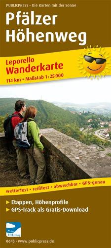
With the hiking map of the Pfälzer Höhenweg, designed in a practical leporello design, you are holding a valuable companion for the hiking trail of the same name. The 'path full of highlights!' - leads from Winnweiler am Donnersberg to Wolfstein in the Palatinate Uplands. Hikers are always offered new heavenly panoramic views, including from 687 m above sea level. NN high Donnersberg and other ridges. In between are castle ruins, visitor mines and picturesque towns as cultural destinations. Due to the design of the hiking map in leporello style, the route is clearly presented in 7 stages with height diagrams and information texts. With the Pfälzer Höhenweg hiking map, individual tour planning is possible.
DELIVERY & RETURNS
UK Delivery:
- Free delivery on all orders of £10 or more.
- £1.49 delivery fee on orders below £10.
- UK orders are shipped via Royal Mail 2nd Class.
International Delivery:
- Flat rate delivery charges vary by country.
Dispatch and Delivery Times:
- All orders are shipped from our warehouse in Northampton, UK within 48 hours of receipt during working hours.
- UK mainland orders typically arrive within 3-5 working days via Royal Mail 2nd Class.
- International estimated delivery times:
- Europe & Channel Islands: 7 to 10 working days
- USA: 7 to 15 working days
- Rest of the World: 9 to 21 working days
View our full delivery infomation here.
-
OVER
2 MILLION PRODUCTS
-
60 MILLION CUSTOMERS
ACROSS 190 COUNTRIES
You might also like
Loading recommendations...