
South Eastern Hochsauerland, Wintermountain - Medebach - Hal
South Eastern Hochsauerland, Wintermountain - Medebach - Hal
Map
Couldn't load pickup availability
Join our rewards scheme and earn reward points on this purchase!
Earn points on this!
Sign in or Sign up!- Release Date: 01/03/2020
- Barcode: 9783899201970
- Genre: Science Nature & Math
- Sub-Genre: Atlases & Maps
- Publisher: Freytag-Berndt
South Eastern Hochsauerland, Wintermountain - Medebach - Hal
Couldn't load pickup availability
Collapsible content
DESCRIPTION
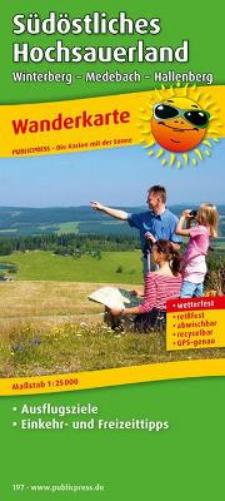
In the south-eastern part of the Sauerland, the Rothaargebirge Nature Park extends with the Kahler Asten (841 m above sea level) as the highest elevation.
In the southeastern part of the Sauerland stretches the Rothaargebirge Nature Park with the Kahler Asten (841 m above sea level) as the highest elevation. The 82 km long Winterberger Hochtour, which starts here as a circular hiking trail, leads through the charming part of the low mountain range. Other long-distance hiking trails are marked in the map section and described on the back. Worth mentioning: Snow World Züschen, the ski area above Züschen with 6 lifts and interesting sports facilities also for the summer.
DELIVERY & RETURNS
UK Delivery:
- Free delivery on all orders of £10 or more.
- £1.49 delivery fee on orders below £10.
- UK orders are shipped via Royal Mail 2nd Class.
International Delivery:
- Flat rate delivery charges vary by country.
Dispatch and Delivery Times:
- All orders are shipped from our warehouse in Northampton, UK within 48 hours of receipt during working hours.
- UK mainland orders typically arrive within 3-5 working days via Royal Mail 2nd Class.
- International estimated delivery times:
- Europe & Channel Islands: 7 to 10 working days
- USA: 7 to 15 working days
- Rest of the World: 9 to 21 working days
View our full delivery infomation here.
-
OVER
2 MILLION PRODUCTS
-
60 MILLION CUSTOMERS
ACROSS 190 COUNTRIES
You might also like
Loading recommendations...