
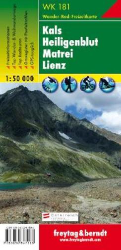
WK 181 Kals - sacredblut - Matrei - Lienz, Walking map 1:50.
WK 181 Kals - sacredblut - Matrei - Lienz, Walking map 1:50.
Map
Couldn't load pickup availability
Join our rewards scheme and earn reward points on this purchase!
Earn points on this!
Sign in or Sign up!- Release Date: 26/07/2018
- Barcode: 9783850847186
- Genre: Non-Fiction
- Sub-Genre: Sports & Hobbies
- Publisher: Freytag-Berndt
WK 181 Kals - sacredblut - Matrei - Lienz, Walking map 1:50.
Couldn't load pickup availability
Collapsible content
DESCRIPTION
freytag & berndt maps are available for many countries and regions in the world. In addition to the precise cartography each map also includes a lot of additional information about the region covered.
The WK 181 'Kals - Heiligenblut - Matrei - Lienz, hiking map 1:50,000' is revised regularly and contains updated information on hiking trails, cycling and mountain biking trails, huts, natural monuments, cultural sights and leisure facilities. The enclosed information booklet contains a selection of the best hiking trails, cycle paths and mountain bike routes as well as a brief description of the individual communities and their leisure activities. (Language: German) Details: leisure information, hiking and long-distance hiking trails, mountain bike and cycling tours, register of places with postcodes, GPS-compatible, via ferrata, ski route, cross-country route, Nordic walking route; Region: Pustertal, Iseltal, Defereggental, Lienz Basin, Lienz Dolomites, Hohe Tauern, Lienz District, East Tyrol, Glockner Group, Mölltal, Oberdrautal, Carinthia; Special themed hiking trails: Jakobsweg, Arnoweg, Adlerweg, Alpe Adria Trail, Through the Zedlacher Paradise, Pustertaler Almweg to Hochstein, Geo-Trail Tauernfenster; Special cycle and mountain bike tours: Drau Cycle Path, Glockner Cycle Path, Iseltal Cycle Path, Lucknerhaus - Glocknerblick, Grünalmtal; Environment maps: WK 120, WK 121, WK 123, WK 182, WK 191, WK 223, WK 225, WK 382; Thanks to the detailed digital cartography and the precise scales, freytag & berndt hiking maps are ideal companions for hiking, mountaineering and ski tours. Grünalmtal; Environment maps: WK 120, WK 121, WK 123, WK 182, WK 191, WK 223, WK 225, WK 382; Thanks to the detailed digital cartography and the precise scales, freytag & berndt hiking maps are ideal companions for hiking, mountaineering and ski tours. Grünalmtal; Environment maps: WK 120, WK 121, WK 123, WK 182, WK 191, WK 223, WK 225, WK 382; Thanks to the detailed digital cartography and the precise scales, freytag & berndt hiking maps are ideal companions for hiking, mountaineering and ski tours.
DELIVERY & RETURNS
UK Delivery:
- Free delivery on all orders of £10 or more.
- £1.49 delivery fee on orders below £10.
- UK orders are shipped via Royal Mail 2nd Class.
International Delivery:
- Flat rate delivery charges vary by country.
Dispatch and Delivery Times:
- All orders are shipped from our warehouse in Northampton, UK within 48 hours of receipt during working hours.
- UK mainland orders typically arrive within 3-5 working days via Royal Mail 2nd Class.
- International estimated delivery times:
- Europe & Channel Islands: 7 to 10 working days
- USA: 7 to 15 working days
- Rest of the World: 9 to 21 working days
View our full delivery infomation here.
-
OVER
2 MILLION PRODUCTS
-
60 MILLION CUSTOMERS
ACROSS 190 COUNTRIES
You might also like
Loading recommendations...