
European by district 1:3.7m, metal-backed
European by district 1:3.7m, metal-backed
Map
Couldn't load pickup availability
Join our rewards scheme and earn reward points on this purchase!
Earn points on this!
Sign in or Sign up!- Release Date: 14/04/2017
- Barcode: 9783850844161
- Genre: Science Nature & Math
- Sub-Genre: Atlases & Maps
- Publisher: Freytag-Berndt

European by district 1:3.7m, metal-backed
Couldn't load pickup availability
Collapsible content
DESCRIPTION
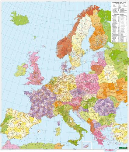
freytag & berndt maps are available for many countries and regions in the world. In addition to the precise cartography each map also includes a lot of additional information about the region covered.
The freytag & berndt 'Europe postcode map' 1:3.7 million is delivered as a rolled map in a plastic roll. Shiny high carbon steel slats are attached to the top and bottom to ensure the map hangs flat and smooth on the wall. Format: approx. 96 x 112 cm; with hanging device. freytag & berndt postcode maps are also available in the following versions: folded, poster (plano in roll), marking board and magnetic marking board.
DELIVERY & RETURNS
UK Delivery:
- Free delivery on all orders of £10 or more.
- £1.49 delivery fee on orders below £10.
- UK orders are shipped via Royal Mail 2nd Class.
International Delivery:
- Flat rate delivery charges vary by country.
Dispatch and Delivery Times:
- All orders are shipped from our warehouse in Northampton, UK within 48 hours of receipt during working hours.
- UK mainland orders typically arrive within 3-5 working days via Royal Mail 2nd Class.
- International estimated delivery times:
- Europe & Channel Islands: 7 to 10 working days
- USA: 7 to 15 working days
- Rest of the World: 9 to 21 working days
View our full delivery infomation here.
-
OVER
2 MILLION PRODUCTS
-
60 MILLION CUSTOMERS
ACROSS 190 COUNTRIES
You might also like
Loading recommendations...