


Kaisergebirge Kufstein WK 301
Kaisergebirge Kufstein WK 301
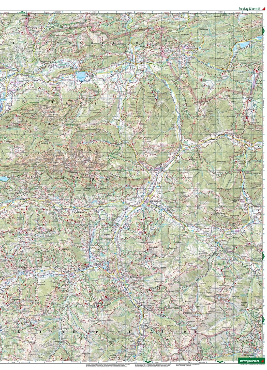
Hiking, Cycling and Leisure Map
Map
Couldn't load pickup availability
Join our rewards scheme and earn reward points on this purchase!
Earn points on this!
Sign in or Sign up!- Release Date: 01/10/2023
- Barcode: 9783707922073
- Genre: Science Nature & Math
- Sub-Genre: Atlases & Maps
- Publisher: Freytag-Berndt


Kaisergebirge Kufstein WK 301
Couldn't load pickup availability
Collapsible content
DESCRIPTION
Hiking, Cycling and Leisure Map
Thanks to the detailed digital cartography and precise scales, freytag & berndt hiking maps are ideal companions for hiking, mountaineering and ski tours.
Thanks to the detailed digital cartography and precise scales, freytag & berndt hiking maps are ideal companions for hiking, mountaineering and ski tours. They are regularly revised and contain updated information on hiking trails, cycling and mountain bike routes, huts, natural monuments, cultural attractions and leisure facilities. The enclosed information booklet contains a selection of the best hiking trails, cycle paths and mountain bike routes as well as a brief description of the individual communities and their leisure activities. (Language: German) Leisure information, hiking and long-distance hiking trails, mountain bike and cycling tours, location register with postal codes, GPS compatible, via ferrata, bridle path, ski route, cross-country ski route, Nordic walking route; Region: Kufstein, Kitzbuhel, Kaiser Mountains, Tyrolean Unterland, Tyrol; Special themed hiking trails: Nordalpeweg, Via Alpina, Adlerweg, Jakobsweg, Hohe Salve high-altitude circular trail, hut tour on the Wilder Kaiser, Pillersee and Teufelskamm, Taubensee, Schwarzsee and Gieringer Weiher; Special cycling and mountain bike tours: Inn cycle path, Mozart cycle path, BikeTail Tirol, Harschbichl;
DELIVERY & RETURNS
UK Delivery:
- Free delivery on all orders of £10 or more.
- £1.49 delivery fee on orders below £10.
- UK orders are shipped via Royal Mail 2nd Class.
International Delivery:
- Flat rate delivery charges vary by country.
Dispatch and Delivery Times:
- All orders are shipped from our warehouse in Northampton, UK within 48 hours of receipt during working hours.
- UK mainland orders typically arrive within 3-5 working days via Royal Mail 2nd Class.
- International estimated delivery times:
- Europe & Channel Islands: 7 to 10 working days
- USA: 7 to 15 working days
- Rest of the World: 9 to 21 working days
View our full delivery infomation here.
-
OVER
2 MILLION PRODUCTS
-
60 MILLION CUSTOMERS
ACROSS 190 COUNTRIES
You might also like
Loading recommendations...