
Eure, Seine-Maritime - Michelin Local Map 304
Eure, Seine-Maritime - Michelin Local Map 304
Map
Couldn't load pickup availability
Join our rewards scheme and earn reward points on this purchase!
Earn points on this!
Sign in or Sign up!- Release Date: 01/03/2008
- Barcode: 9782067209954
- Genre: Travel & Transport
- Subgenre: Atlases & Maps
Eure, Seine-Maritime - Michelin Local Map 304
Couldn't load pickup availability
Collapsible content
DESCRIPTION
Map
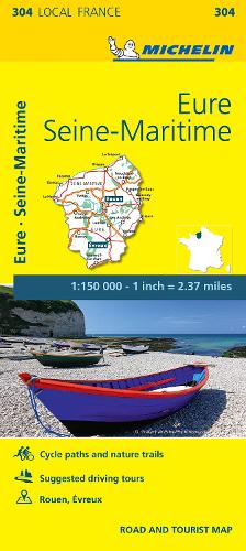
Michelin local maps are on a scale of 1:150,000 up 1:220,000 with easy to read mapping using satellite images. With additional tourist information, these maps are ideal for planning your visit. Series for France and Italy.
(Edition updated in 2018) The MICHELIN Eure, Seine-Maritime local map, scale 1/150,000 is the ideal companion to fully explore these French local areas and provides star-rated Michelin tourist itineraries and attractions, as well as impressive 3D relief mapping. MICHELIN local maps are perfect for cyclists and outdoor enthusiasts with over 20 leisure symbols, extensive coverage of cycling paths and nature trails. With MICHELIN local maps, find more than just your way! MICHELIN LOCAL MAPS provide detailed coverage of France are perfect for fully exploring these countries and are also ideal for cyclists.* Impressive & realistic 3D relief mapping* Michelin selected itineraries and must-sees of the area* A clear and comprehensive key with 20 leisure symbols, as well as cycling paths and nature trails. * Star rated tourist sights and attractions cross-referenced with the famous MICHELIN Green Guides.* Plans of main cities and a comprehensive place name index
DELIVERY & RETURNS
UK Delivery:
- Free delivery on all orders of £10 or more.
- £1.49 delivery fee on orders below £10.
- UK orders are shipped via Royal Mail 2nd Class.
International Delivery:
- Flat rate delivery charges vary by country.
Dispatch and Delivery Times:
- All orders are shipped from our warehouse in Northampton, UK within 48 hours of receipt during working hours.
- UK mainland orders typically arrive within 3-5 working days via Royal Mail 2nd Class.
- International estimated delivery times:
- Europe & Channel Islands: 7 to 10 working days
- USA: 7 to 15 working days
- Rest of the World: 9 to 21 working days
View our full delivery infomation here.
-
OVER
2 MILLION PRODUCTS
-
60 MILLION CUSTOMERS
ACROSS 190 COUNTRIES
You might also like
Loading recommendations...