
Philip's RGS Children's School Atlas
Philip's RGS Children's School Atlas
Paperback edition
Paperback
Couldn't load pickup availability
Join our rewards scheme and earn reward points on this purchase!
Earn points on this!
Sign in or Sign up!- Release Date: 03/10/2024
- Barcode: 9781849076920
- Genre: Children's Learning & Education
- Sub-Genre: Science & Technology
- Publisher: Octopus Publishing

Philip's RGS Children's School Atlas
Couldn't load pickup availability
Collapsible content
DESCRIPTION
Paperback edition "This is such a great book for primary school age children and a little beyond for finding out about the world, its countries and people" customer review
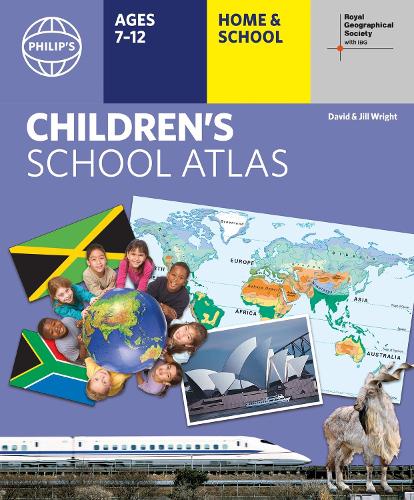
Clear and accurate maps are combined with fascinating facts about the countries of the world to provide essential geographical information for young readers aged 7-12. Guidance for parents and teachers is given on how to use the maps, encouraging early development of geographical skills.
- Philip's atlas, designed to use at home and at school with guidance for parents and teachers
- Clear maps and fascinating facts bring geography to life for readers aged 7-12
- Published by Philip's in association with the Royal Geographical Society
- Quizzes, activity ideas and puzzles to make learning fun
- Past winner of the Geographical Association's award for making a significant contribution to geography
The atlas is organized spread by spread in the classic sequence: first Europe, then its land neighbour Asia, followed by Africa, Australia and Oceania, North America and South America. Illustrated with captivating full-colour photographs and packed with fact boxes, curiosities, flags, stamps and quiz questions, Philip's RGS Children's Atlas is both fun to use and easy to understand.
Now in its 17th edition, Philip's RGS Children's Atlas is a past winner of the Geographical Association's award for making a significant contribution to geography. The atlas was judged "an excellent 'all round' children's atlas with simple yet well-designed maps, well-illustrated with colour photographs. It links places to issues, events and real people, giving a clear sense of place."
DELIVERY & RETURNS
UK Delivery:
- Free delivery on all orders of £10 or more.
- £1.49 delivery fee on orders below £10.
- UK orders are shipped via Royal Mail 2nd Class.
International Delivery:
- Flat rate delivery charges vary by country.
Dispatch and Delivery Times:
- All orders are shipped from our warehouse in Northampton, UK within 48 hours of receipt during working hours.
- UK mainland orders typically arrive within 3-5 working days via Royal Mail 2nd Class.
- International estimated delivery times:
- Europe & Channel Islands: 7 to 10 working days
- USA: 7 to 15 working days
- Rest of the World: 9 to 21 working days
View our full delivery infomation here.
-
OVER
2 MILLION PRODUCTS
-
60 MILLION CUSTOMERS
ACROSS 190 COUNTRIES
You might also like
Loading recommendations...