
2024 Philip's Road Atlas Britain and Ireland
2024 Philip's Road Atlas Britain and Ireland
Spiral Bound
Couldn't load pickup availability
Join our rewards scheme and earn reward points on this purchase!
Earn points on this!
Sign in or Sign up!- Release Date: 01/06/2023
- Barcode: 9781849076241
- Genre: Travel & Transport
- Subgenre: Atlases & Maps

2024 Philip's Road Atlas Britain and Ireland
Couldn't load pickup availability
Collapsible content
DESCRIPTION
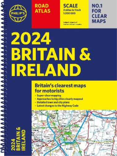
Philip's is No. 1 in the UK for clear mapping and the Philip's 2024 Road Atlas Britain and Ireland is the top of the range, A4-sized, paperback atlas featuring fully updated maps from the Philip's digital database. The maps are super-clear and have been voted Britain's clearest and most detailed in an independent consumer survey. PHILIP'S - The UK's most trusted clear maps
'Good balance between detail and clarity with excellent town maps' What Car?
* Super-clear mapping at a scale of 3 miles to 1 inch = 1:200,000
* Includes the latest highway code requirements
* Completely updated and revised for 2024
* New map showing Smart Motorways
- Practical spiral bound, lie-flat format
- 160 pages of fully updated super-clear road maps
- 10 pages of detailed route-planning maps - plan your route in advance
- 88 indexed town-centre maps
- 14 pages of city approach maps with named arterial roads
- 2 page road map of Ireland
- Map of scenic Britain and a map highlighting railways, airports and ferry ports
Philip's 2024 Road Atlas Britain and Ireland is the top-of-the-range spiral road atlas featuring the latest maps from the Philip's digital database. Voted Britain's clearest and most detailed in an independent consumer survey, the mapping is super-clear.
Philip's 2024 Road Atlas Britain and Ireland contains 160 pages of road maps covering Britain at 3 miles to 1 inch, with the Western Isles, Orkney and Shetland at smaller scales. The maps clearly mark service areas, roundabouts and multi-level junctions, and in rural areas distinguish between roads over and under 4 metres wide.
The atlas also includes a 2-page road map of Ireland, 10 pages of route-planning maps, a distance table, 10 large-scale city approach maps with named arterial roads, and 88 extra-detailed and fully indexed town and city plans.
DELIVERY & RETURNS
UK Delivery:
- Free delivery on all orders of £10 or more.
- £1.49 delivery fee on orders below £10.
- UK orders are shipped via Royal Mail 2nd Class.
International Delivery:
- Flat rate delivery charges vary by country.
Dispatch and Delivery Times:
- All orders are shipped from our warehouse in Northampton, UK within 48 hours of receipt during working hours.
- UK mainland orders typically arrive within 3-5 working days via Royal Mail 2nd Class.
- International estimated delivery times:
- Europe & Channel Islands: 7 to 10 working days
- USA: 7 to 15 working days
- Rest of the World: 9 to 21 working days
View our full delivery infomation here.
-
OVER
2 MILLION PRODUCTS
-
60 MILLION CUSTOMERS
ACROSS 190 COUNTRIES
You might also like
Loading recommendations...