
C41 Les Sables d'Olonne to La Gironde
C41 Les Sables d'Olonne to La Gironde
Les Sables d'Olonne to La Gironde
Map
Couldn't load pickup availability
Join our rewards scheme and earn reward points on this purchase!
Earn points on this!
Sign in or Sign up!- Release Date: 15/02/2024
- Barcode: 9781846238796
- Genre: Sports & Hobbies
- Sub-Genre: Sport & Outdoor Recreation

C41 Les Sables d'Olonne to La Gironde
Couldn't load pickup availability
Collapsible content
DESCRIPTION
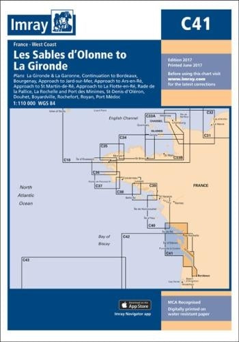
Plans Bourgenay Approach to Jard-sur-Mer Approach to Ars-en-Re Approach to St Martin-de-Re Approach to La Flotte-en-Re Rade de la Pallice La Rochelle and Port des Minimes St-Denis-d'Oleron Douhet Boyardville Rochefort Royan Port Medoc La Gironde & La Garonne Continuation to Bordeaux
Plans included: Bourgenay (1:10 000) Approach to Jard-sur-Mer (1:17 500) Approach to Ars-en-Ré (1:40 000) Approach to St Martin-de-Ré (1:15 000) Approach to La Flotte-en-Ré (1:15 000) Rade de la Pallice (1:40 000) La Rochelle and Port des Minimes (1:15 000) St-Denis-d'Oléron (1:10 000) Douhet (1:7500) Boyardville (1:10 000) Rochefort (1:10 000) Royan (1:7500) Port Médoc (1:12 500) La Gironde & La Garonne (1:200 000) Continuation to Bordeaux (1:200 000) On this edition the latest depth surveys have been applied where available. Harbour and marina development at Port Minimes and La Pallice are included as is the latest information on nature and marine reserves. The La Gironde to Bordeaux plan has improved detail and increased usability. The chart specification has been improved to show coloured light flashes. There has been general updating throughout.
DELIVERY & RETURNS
UK Delivery:
- Free delivery on all orders of £10 or more.
- £1.49 delivery fee on orders below £10.
- UK orders are shipped via Royal Mail 2nd Class.
International Delivery:
- Flat rate delivery charges vary by country.
Dispatch and Delivery Times:
- All orders are shipped from our warehouse in Northampton, UK within 48 hours of receipt during working hours.
- UK mainland orders typically arrive within 3-5 working days via Royal Mail 2nd Class.
- International estimated delivery times:
- Europe & Channel Islands: 7 to 10 working days
- USA: 7 to 15 working days
- Rest of the World: 9 to 21 working days
View our full delivery infomation here.
-
OVER
2 MILLION PRODUCTS
-
60 MILLION CUSTOMERS
ACROSS 190 COUNTRIES
You might also like
Loading recommendations...