
An Historical Map of Cambridge
An Historical Map of Cambridge
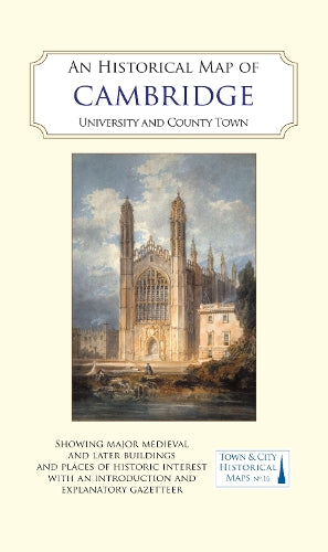
University and County Town
Map
Couldn't load pickup availability
Join our rewards scheme and earn reward points on this purchase!
Earn points on this!
Sign in or Sign up!- Release Date: 30/10/2023
- Barcode: 9781838071950
- Genre: Science Nature & Math
- Sub-Genre: Atlases and Maps
An Historical Map of Cambridge
Couldn't load pickup availability
Collapsible content
DESCRIPTION
University and County Town
A full colour map, based on a digitised OS map of Cambridge published in 1927, with its medieval, Georgian, Victorian and Edwardian past overlain and important buildings picked out.
A full colour map, based on a digitised OS map of Cambridge published in 1927, with its medieval, Georgian, Victorian and Edwardian past overlain and important buildings picked out. Cambridge is one of England's two ancient university towns. It was an important trading centre for the Romans and then the Anglo-Saxons. The town was the location for a castle built on rising ground above the flood plain of the River Cam, by William I in about 1068. In about 1209 the first students of what was to become the University arrived from Oxford, and the first college (Peterhouse) was founded in 1284.The city (it became a city only in 1951) is home to some of the best-known and most familiar university buildings in the country including King's College Chapel, the University Church and the Senate House, Trinity College's Wren Library and the Victorian chapel of St John's College. From the 16th century, many of the colleges created extensive grounds along both sides of the river, resulting in the famous Cambridge 'Backs' of today. But the town was also the county town of Cambridgeshire with a Shire Hall, and it developed its own identity and status as a town through various charters, with a guildhall to serve its local government. It transformed from a service economy supporting the university, with a substantial publishing presence, when, in the 19th century, it developed an industrial base (milling, malting, brewing, iron-founding, brick-making and cement manufacture); it also became a major railway centre. As a result, its suburbs expanded, especially to the east of the town centre. The historical map shows the sites of the town's major buildings, both existing in 1927 and lost by then, its vanished medieval buildings, the site of the castle and shire hall.The map's cover has a short introduction to the town's history, and on the reverse an illustrated and comprehensive gazetteer of Cambridge's main sites of historical interest.
DELIVERY & RETURNS
UK Delivery:
- Free delivery on all orders of £10 or more.
- £1.49 delivery fee on orders below £10.
- UK orders are shipped via Royal Mail 2nd Class.
International Delivery:
- Flat rate delivery charges vary by country.
Dispatch and Delivery Times:
- All orders are shipped from our warehouse in Northampton, UK within 48 hours of receipt during working hours.
- UK mainland orders typically arrive within 3-5 working days via Royal Mail 2nd Class.
- International estimated delivery times:
- Europe & Channel Islands: 7 to 10 working days
- USA: 7 to 15 working days
- Rest of the World: 9 to 21 working days
View our full delivery infomation here.
-
OVER
2 MILLION PRODUCTS
-
60 MILLION CUSTOMERS
ACROSS 190 COUNTRIES
You might also like
Loading recommendations...