
Imray Chart G15
Imray Chart G15
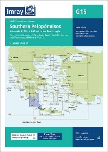
Ormos Navarinou to Nisos Kithira and Akra Tourkovigla
Map
Couldn't load pickup availability
Join our rewards scheme and earn reward points on this purchase!
Earn points on this!
Sign in or Sign up!- Release Date: 30/01/2024
- Barcode: 9781786795502
- Genre: Science Nature & Math
- Sub-Genre: Earth Sciences

Imray Chart G15
Couldn't load pickup availability
Collapsible content
DESCRIPTION
Ormos Navarinou to Nisos Kithira and Akra Tourkovigla
This edition includes the latest official data combined with additional information sourced from Imray''s network to make it ideal for small craft. It includes the latest official bathymetric surveys. There has been general updating throughout.
Chart scale 1:190 000Plans included:Liménas Kalamátas (1:12 500)Yíthion (1:12 500)Órmos Kapsáli (1:5000)Dhiakofti (1:12 500)Monemvasía (Yéfira) (1:7500)Nísos Andikíthera to Nísos Kríti (1:190 000)Imray-Tetra charts for the Ionian and Aegean are widely acknowledged as the best available for the cruising sailor. They combine the latest official survey data with first-hand information gathered by Rod and Lucinda Heikell. The chart is designed to be used alongside Imray pilot guides of the area. Like all Imray charts, they are printed on water resistant Pretex paper for durability, and they include many anchorages, facilities and inlets not included on official charts.This edition includes the latest official data combined with additional information sourced from Imray's network to make it ideal for small craft. It includes the latest official bathymetric surveys. There has been general updating throughout.
DELIVERY & RETURNS
UK Delivery:
- Free delivery on all orders of £10 or more.
- £1.49 delivery fee on orders below £10.
- UK orders are shipped via Royal Mail 2nd Class.
International Delivery:
- Flat rate delivery charges vary by country.
Dispatch and Delivery Times:
- All orders are shipped from our warehouse in Northampton, UK within 48 hours of receipt during working hours.
- UK mainland orders typically arrive within 3-5 working days via Royal Mail 2nd Class.
- International estimated delivery times:
- Europe & Channel Islands: 7 to 10 working days
- USA: 7 to 15 working days
- Rest of the World: 9 to 21 working days
View our full delivery infomation here.
-
OVER
2 MILLION PRODUCTS
-
60 MILLION CUSTOMERS
ACROSS 190 COUNTRIES
You might also like
Loading recommendations...