
Map of the River Thames
Map of the River Thames
Map
Couldn't load pickup availability
Join our rewards scheme and earn reward points on this purchase!
Earn points on this!
Sign in or Sign up!- Release Date: 30/03/2021
- Barcode: 9781786792532
- Genre: Technology & Engineering
- Sub-Genre: Environmental Science

Map of the River Thames
Couldn't load pickup availability
Collapsible content
DESCRIPTION
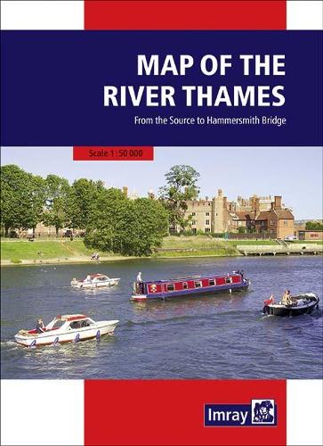
This popular map of the non-tidal Thames from its the source above Cricklade to the entrance of the Grand Union Canal at Brentford below Teddington Locks is convenient in any cockpit and is the ideal companion to Chris Cove-Smith’s River Thames Book.
A passage chart designed for planning and navigating across the North Atlantic between Gibraltar, the Azores and the Canary Islands. Based on official Hydrographic Office data with additional information from across Imray's network, tailored to appropriate scales and level of data for leisure sailors. Imray's award-winning cartography includes a familiar, logical colour scheme, coloured light sectors and fine overprinted latitude and longitude grids to make plotting easier. On this edition the magnetic variation curves have been updated with the latest data. There has been general updating throughout.
DELIVERY & RETURNS
UK Delivery:
- Free delivery on all orders of £10 or more.
- £1.49 delivery fee on orders below £10.
- UK orders are shipped via Royal Mail 2nd Class.
International Delivery:
- Flat rate delivery charges vary by country.
Dispatch and Delivery Times:
- All orders are shipped from our warehouse in Northampton, UK within 48 hours of receipt during working hours.
- UK mainland orders typically arrive within 3-5 working days via Royal Mail 2nd Class.
- International estimated delivery times:
- Europe & Channel Islands: 7 to 10 working days
- USA: 7 to 15 working days
- Rest of the World: 9 to 21 working days
View our full delivery infomation here.
-
OVER
2 MILLION PRODUCTS
-
60 MILLION CUSTOMERS
ACROSS 190 COUNTRIES
You might also like
Loading recommendations...