
Appalachian Trail: Bailey Gap to Calf Mountain Map
Appalachian Trail: Bailey Gap to Calf Mountain Map
Topographic Map Guides
Map
Couldn't load pickup availability
Join our rewards scheme and earn 96 reward points on this purchase!
Earn 96 points on this!
Sign in or Sign up!- Release Date: 31/12/2015
- Barcode: 9781597756419
- Genre: Science Nature & Math
- Sub-Genre: Atlases & Maps
- Imprint: National Geographic
Appalachian Trail: Bailey Gap to Calf Mountain Map
Standard Edition
Couldn't load pickup availability
Collapsible content
DESCRIPTION
Topographic Map Guides
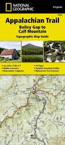
• Waterproof • Tear-Resistant • Topographic MapThe Bailey Gap to Calf Mountain Topographic Map Guide makes a perfect traveling companion when traversing the central Virginia section of the Appalachian Trail (A.T.). The A.T. in central Virginia falls mostly within National Forest land, traveling through mature forests and over high mountain summits. The trail becomes more difficult as hikers go farther south, traversing the A.T.'s northernmost balds, past interesting rock formations, and over notable peaks, such as the Priest, McAfee Knob, and Dragon's Tooth.Each A.T. Topographic Map Guide includes detailed topographic maps at a detail of 1 inch = 1 mile. Each page is centered on the A.T. and overlaps with the adjacent pages so there is little chance of getting lost. Along the bottom of each page is a trail profile that shows the distance between shelters, camping areas, and trail access points. The map and trail profile provide a step by step visual guide to hiking the trail, mile by rugged mile. The Topographic Map Guide is built for all levels of hiking enthusiasts, from the day tripper to the multi month 'thru-hiker'. The front pages of the printed Topographic Map Guide include resupply information, town inset maps, camping options, and much more.Every Topographic Map Guide is printed on 'Backcountry Tough' waterproof, tear-resistant paper. A full UTM grid is printed on the map to aid with GPS navigation.Other features found on this map include: Afee Knob, Apple Orchard Mountain, Appomattox, Bailey Gap Shelter, Black Horse Gap, Bobblets Gap Shelter, Brown Mtn Creek Shelter, Bryant Ridge Shelter, Calf Mountain, Calf Mtn Shelter, Campbell Shelter, Catawba Mtn Shelter, Cornelius Creek Shelter, Cove Mountain Shelter, Cow Camp Gap Shelter, Fullhardt Knob Shelter, George Washington National Forest, Harpers Creek Shelter, Humpback Mountain, Jefferson National Forest, Johns Hollow Shelter, Johns Spring Shelter, Lamberts Meadow Shelter, Laurel Creek Shelter, Lynchburg, Matts Creek Shelter, Maupin Field Shelter, Niday Shelter, Paul C. Wolfe Shelter, Pickle Branch Shelter, Pine Swamp Branch Shelter, Punchbowl Shelter, Reeds Gap, Rockfish Gap, Sarver Hollow Shelter, Seeley- Woodworth Shelter, The Priest, The Priest Shelter, Thunder Hill Shelter, Troutville, War Spur Shelter, Waynesboro, Wilson Creek Shelter.
DELIVERY & RETURNS
UK Delivery:
- Free delivery on all orders of £10 or more.
- £1.49 delivery fee on orders below £10.
- UK orders are shipped via Royal Mail 2nd Class.
International Delivery:
- Flat rate delivery charges vary by country.
Dispatch and Delivery Times:
- All orders are shipped from our warehouse in Northampton, UK within 48 hours of receipt during working hours.
- UK mainland orders typically arrive within 3-5 working days via Royal Mail 2nd Class.
- International estimated delivery times:
- Europe & Channel Islands: 7 to 10 working days
- USA: 7 to 15 working days
- Rest of the World: 9 to 21 working days
View our full delivery infomation here.
-
OVER
2 MILLION PRODUCTS
-
60 MILLION CUSTOMERS
ACROSS 190 COUNTRIES
You might also like
Loading recommendations...