
Buffalo National River (Map Pack)
Buffalo National River (Map Pack)
Trails Illustrated Maps
Map
Couldn't load pickup availability
Join our rewards scheme and earn reward points on this purchase!
Earn points on this!
Sign in or Sign up!- Release Date: 04/09/2020
- Barcode: 9781566958936
- Genre: Science Nature & Math
- Sub-Genre: Atlases & Maps
- Imprint: National Geographic
Buffalo National River (Map Pack)
Standard Edition
Couldn't load pickup availability
Collapsible content
DESCRIPTION
Trails Illustrated Maps
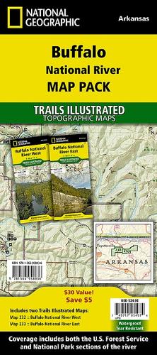
• Waterproof • Tear-Resistant • Topographic MapsThe first National River to be designated in the United States, the Buffalo River flows 153 miles through the tranquil forests and dramatic sandstone and limestone bluffs of the Ozarks. National Geographic's Trails Illustrated Map Pack of the Buffalo National River combines unmatched detail with helpful information to offer an invaluable tool for making the most of your visit to one of the few remaining undammed rivers in the lower 48 states. Created in partnership with local land management agencies, these expertly researched maps include sections of the river from the Upper Buffalo Wilderness and the Ozark National Forest, through Boxley Valley to the Little Buffalo River, then through to Woolum. Also included are the Lower Buffalo and Leatherwood Wilderness Areas, Gene Rush Wildlife Management Area and parts of Ozark National ForestSummaries of popular hiking and horse trails will help you choose the route that's right for you. The clearly marked trails include mileages between intersections. Handy river mileage and services charts are included as well. The map bases include contour lines and elevations for summits and passes. Some of the many recreation features include interpretive trails, campgrounds, trailheads, river access, waterfalls, horse camps, and scenic areas. Information on caves, canoeing and water safety, recreational activities, and more will help guide you in exploring all the region has to offer.Buy the Map Pack and save 15%!The Buffalo National River Map Pack includes: • Map 232 :: Buffalo National River West • Map 233 :: Buffalo National River EastEvery Trails Illustrated map is printed on 'Backcountry Tough' waterproof, tear-resistant paper. A full UTM grid is printed on the map to aid with GPS navigation.
DELIVERY & RETURNS
UK Delivery:
- Free delivery on all orders of £10 or more.
- £1.49 delivery fee on orders below £10.
- UK orders are shipped via Royal Mail 2nd Class.
International Delivery:
- Flat rate delivery charges vary by country.
Dispatch and Delivery Times:
- All orders are shipped from our warehouse in Northampton, UK within 48 hours of receipt during working hours.
- UK mainland orders typically arrive within 3-5 working days via Royal Mail 2nd Class.
- International estimated delivery times:
- Europe & Channel Islands: 7 to 10 working days
- USA: 7 to 15 working days
- Rest of the World: 9 to 21 working days
View our full delivery infomation here.
-
OVER
2 MILLION PRODUCTS
-
60 MILLION CUSTOMERS
ACROSS 190 COUNTRIES
You might also like
Loading recommendations...