
Santa Fe, Truchas Peak Map
Santa Fe, Truchas Peak Map
Trails Illustrated Maps
Map
Couldn't load pickup availability
Join our rewards scheme and earn reward points on this purchase!
Earn points on this!
Sign in or Sign up!- Release Date: 01/01/2019
- Barcode: 9781566956772
- Genre: Science Nature & Math
- Sub-Genre: Atlases & Maps
- Imprint: National Geographic
Santa Fe, Truchas Peak Map
Standard Edition
Couldn't load pickup availability
Collapsible content
DESCRIPTION
Trails Illustrated Maps
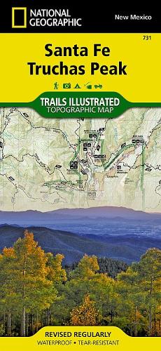
• Waterproof • Tear-Resistant • Topographic MapNational Geographic's Trails Illustrated map of the Truchas Peak and Santa Fe was designed for all outdoor enthusiasts enjoying the recreational opportunities around Santa Fe. Expertly researched and created in cooperation with the U.S. Forest Service and others, the map covers the area's wide range of public recreation lands with unparalleled detail. Coverage includes Santa Fe and Carson National Forests; Pecos Wilderness, River and National Historical Park; Picuris, Nambe, Tesuque Pueblos; Morphy Lake and Hyde Memorial State Parks; Santa Fe Canyon Preserve; and Open Space Parks.Get off the beaten bath and back on again by following the map along clearly mapped trails, shown with mileage markers and colored for motorized or non-motorized use, including the area's National Recreation Trails. Your navigation will be aided by the map's contour lines, elevations, labeled peaks and summits, water features, numbered Forest Service roads and clear color-coded boundaries for different land designations. Those preferring to explore by road will find the El Camino Real, Santa Fe Trail, Historic Route 66 and High Road to Taos Scenic Byways, all shown with their roadside points of interest. Other recreation features include trailheads, interpretive trails, campgrounds, RV campgrounds and dump stations, cross-country ski trails, alpine ski areas, boat ramps, canoe and fishing areas, lookout towers and scenic viewpoints. Every Trails Illustrated map is printed on 'Backcountry Tough' waterproof, tear-resistant paper. A full UTM grid is printed on the map to aid with GPS navigation.Other features found on this map include: Carson National Forest, Pecos National Historical Park, Pecos Wilderness, Rincon Mountains, Santa Fe, Santa Fe Baldy, Santa Fe National Forest, Truchas Peak.
DELIVERY & RETURNS
UK Delivery:
- Free delivery on all orders of £10 or more.
- £1.49 delivery fee on orders below £10.
- UK orders are shipped via Royal Mail 2nd Class.
International Delivery:
- Flat rate delivery charges vary by country.
Dispatch and Delivery Times:
- All orders are shipped from our warehouse in Northampton, UK within 48 hours of receipt during working hours.
- UK mainland orders typically arrive within 3-5 working days via Royal Mail 2nd Class.
- International estimated delivery times:
- Europe & Channel Islands: 7 to 10 working days
- USA: 7 to 15 working days
- Rest of the World: 9 to 21 working days
View our full delivery infomation here.
-
OVER
2 MILLION PRODUCTS
-
60 MILLION CUSTOMERS
ACROSS 190 COUNTRIES
You might also like
Loading recommendations...