
Bend, Three Sisters Map
Bend, Three Sisters Map
Trails Illustrated Maps
Map
Couldn't load pickup availability
Join our rewards scheme and earn reward points on this purchase!
Earn points on this!
Sign in or Sign up!- Release Date: 01/01/2012
- Barcode: 9781566956628
- Genre: Science Nature & Math
- Sub-Genre: Atlases & Maps
- Imprint: National Geographic
Bend, Three Sisters Map
Standard Edition
Couldn't load pickup availability
Collapsible content
DESCRIPTION
Trails Illustrated Maps
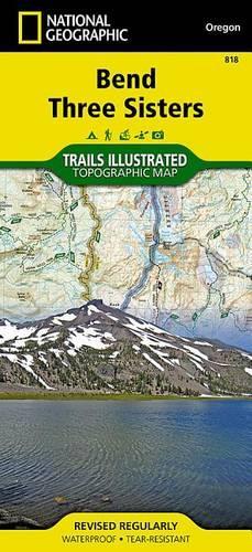
• Waterproof • Tear-Resistant • Topographic MapNational Geographic's Trails Illustrated map of Bend and Three Sisters is designed to meet the needs of outdoor enthusiasts seeking to explore the mountains and wildernesses in this part of central Oregon. With three of Oregon's highest peaks and one of the largest wilderness areas, the area not only has a great diversity of vegetation but also of adventure and recreation activities, which are featured on the map, for example: approximately 260 miles of trails, campgrounds, campsites, cabins, resorts and yurts, boating ramps, swimming and windsurfing areas, waterfalls, hot springs, skiing areas and rock climbing areas.Created in partnership with local land management agencies, the map base has contour lines and elevations of peaks and waterways. The trails of the area are all highlighted with mileage markers and colored according to their designated usage. Among the well known trails displayed are the Pacific Crest Trail, that traverses the Three Sisters Wilderness for about 40 miles, the Metolius-Windigo trail and the French Pete Trail. The McKenzie Pass, Santiam Pass and Cascade Lakes Byways are also highlighted for those who wish to explore the area by car. Also included on the maps are safety tips and seasonal hazards to help ensure the safety of everyone exploring the area. The map includes the following areas of interest: Newberry National Volcanic Monument, Willamette and Deschutes National Forest, Mount Washington, Waldo Lake and Three Sisters Wilderness and more.Every Trails Illustrated map is printed on 'Backcountry Tough' waterproof, tear-resistant paper. A full UTM grid is printed on the map to aid with GPS navigation.Other features found on this map include: Bend, Black Butte, Cougar Reservoir, Cultus Mountain, Deschutes National Forest, Little Deschutes River, Mount Bachelor, Mount Washington Wilderness, North Sister, Redmond, South Sister, Three Sisters, Three Sisters Wilderness, Waldo Lake Wilderness, Willamette National Forest.
DELIVERY & RETURNS
UK Delivery:
- Free delivery on all orders of £10 or more.
- £1.49 delivery fee on orders below £10.
- UK orders are shipped via Royal Mail 2nd Class.
International Delivery:
- Flat rate delivery charges vary by country.
Dispatch and Delivery Times:
- All orders are shipped from our warehouse in Northampton, UK within 48 hours of receipt during working hours.
- UK mainland orders typically arrive within 3-5 working days via Royal Mail 2nd Class.
- International estimated delivery times:
- Europe & Channel Islands: 7 to 10 working days
- USA: 7 to 15 working days
- Rest of the World: 9 to 21 working days
View our full delivery infomation here.
-
OVER
2 MILLION PRODUCTS
-
60 MILLION CUSTOMERS
ACROSS 190 COUNTRIES
You might also like
Loading recommendations...