
Skyline Boulevard Map
Skyline Boulevard Map
Trails Illustrated Maps
Map
Couldn't load pickup availability
Join our rewards scheme and earn reward points on this purchase!
Earn points on this!
Sign in or Sign up!- Release Date: 26/09/2013
- Barcode: 9781566956307
- Genre: Science Nature & Math
- Sub-Genre: Atlases & Maps
- Imprint: National Geographic
Skyline Boulevard Map
Standard Edition
Couldn't load pickup availability
Collapsible content
DESCRIPTION
Trails Illustrated Maps
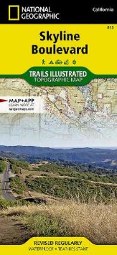
• Waterproof • Tear-Resistant • Topographic MapRunning along the side of the Santa Cruz Mountains, Skyline Boulevard is known for its scenic attractions and unlimited recreational opportunities. Outdoor enthusiasts exploring this California Scenic Byway and surrounding area will find National Geographic's Trails Illustrated map of Skyline Boulevard and indispensable tool. Expertly researched and created in partnership with Midpeninsula Regional Open Space, California State Parks and others, the map covers the Skyline Boulevard area with unparalleled detail, starting from Golden Gate National Recreation Area's Milagra Ridge and Mori Point in the northwest to Sanborn-Skyline Park and Castle Rock State Park in the southeast. Coverage includes tens of state and county parks and beaches, open space preserves (MROSD) and other public recreation areas; miles of California shoreline, including Half Moon Bay State Beach and Monterey Bay National Marine Sanctuary; South San Francisco and San Mateo; and the Santa Cruz Mountains.Use the trail charts to select a route to explore, according to location, distance and designated use and then follow along the hundreds of miles of precisely mapped trails and fire roads, shown with mileage markers. The Bay Area Ridge, Skyline-to-the-Sea and California Coastal Trails are all labeled. The Pacific Coast Highway is shown with roadside parking and pulloff areas. Navigate using the map's contour lines and elevations, water features and clear boundaries between public and private land. Recreation features include areas for camping, picnics, fishing, climbing, swimming, surfing, wind surfing and wildlife viewing. Among the other attractions pinpointed area marinas, wineries, museums, old growth redwood forests, lighthouses and scenic viewpoints.Every Trails Illustrated map is printed on 'Backcountry Tough' waterproof, tear-resistant paper. A full UTM grid is printed on the map to aid with GPS navigation.Other features found on this map include: Belmont, Burlingame, Foster City, Golden Gate National Recreation Area, Half Moon Bay, Hillsborough, Los Altos, Millbrae, Montara Mountain, Mountain View, Pacifica, Pescadero Point, Pillar Point, Point San Pedro, San Andreas Lake, San Bruno, San Carlos, San Mateo, South San Francisco, Upper Crystal Springs Reservoir.
DELIVERY & RETURNS
UK Delivery:
- Free delivery on all orders of £10 or more.
- £1.49 delivery fee on orders below £10.
- UK orders are shipped via Royal Mail 2nd Class.
International Delivery:
- Flat rate delivery charges vary by country.
Dispatch and Delivery Times:
- All orders are shipped from our warehouse in Northampton, UK within 48 hours of receipt during working hours.
- UK mainland orders typically arrive within 3-5 working days via Royal Mail 2nd Class.
- International estimated delivery times:
- Europe & Channel Islands: 7 to 10 working days
- USA: 7 to 15 working days
- Rest of the World: 9 to 21 working days
View our full delivery infomation here.
-
OVER
2 MILLION PRODUCTS
-
60 MILLION CUSTOMERS
ACROSS 190 COUNTRIES
You might also like
Loading recommendations...