

Salt River Canyon Map (Tonto National Forest)
Salt River Canyon Map (Tonto National Forest)
Trails Illustrated Maps
Map
Couldn't load pickup availability
Join our rewards scheme and earn reward points on this purchase!
Earn points on this!
Sign in or Sign up!- Release Date: 02/08/2012
- Barcode: 9781566954877
- Genre: Science Nature & Math
- Sub-Genre: Atlases & Maps
- Imprint: National Geographic
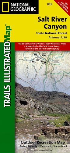

Salt River Canyon Map (Tonto National Forest)
Standard Edition
Couldn't load pickup availability
Collapsible content
DESCRIPTION
Trails Illustrated Maps
• Waterproof • Tear-Resistant • Topographic MapFlowing across the southern part of Tonto National Forest, Salt River provides abundant recreational opportunities just outside of Phoenix. Created in cooperation with the U.S. Forest Service, Bureau of Land Management and others, National Geographic's Trail Illustrated Map of Salt River Canyon is an essential travel companion for outdoor enthusiasts seeking land and water adventures in the area. Coverage includes many popular recreation sites in and around Tonto National Forest such as Superstition, White Canyon, Sierra Ancha and Salt River Canyon Wilderness Areas. More than 50 miles of the Salt River is shown along with its river access points and fishing areas until it flows into the Theodore Roosevelt Lake. Whether you explore the area on foot, bike or horseback, you can get off the beaten path and back on again by following the map to clearly marked trailheads and then along trails that are colored according to their designated usage, including the Arizona Trail. Your navigation will be aided by the map's contour lines and elevations, labeled peaks and summits, water features, areas of wooded cover, selected waypoints and clear color-coded boundaries between national forest, wilderness and tribal land. Additionally, a complete road network of the area is shown, including numbered Forest Service roads and scenic byways are labeled. Some additional recreation points of interest are campgrounds, RV campgrounds, horse camps, interpretive trails, picnic areas and scenic viewpoints. Every Trails Illustrated map is printed on 'Backcountry Tough' waterproof, tear-resistant paper. A full UTM grid is printed on the map to aid with GPS navigation.Other features found on this map include: Aztec Peak, Mescal Mountains, Rockinstraw Mountain, Salt River Canyon Wilderness, Sierra Ancha Wilderness, Sombrero Peak, Superstition Wilderness, Tonto National Forest.
DELIVERY & RETURNS
UK Delivery:
- Free delivery on all orders of £10 or more.
- £1.49 delivery fee on orders below £10.
- UK orders are shipped via Royal Mail 2nd Class.
International Delivery:
- Flat rate delivery charges vary by country.
Dispatch and Delivery Times:
- All orders are shipped from our warehouse in Northampton, UK as soon as stock is available.
- UK mainland orders typically arrive within 3-7 working days via Royal Mail 2nd Class.
- International estimated delivery times:
- Europe & Channel Islands: 7 to 10 working days
- USA: 7 to 15 working days
- Rest of the World: 9 to 30 working days
View our full delivery infomation here.
-
OVER
2 MILLION PRODUCTS
-
60 MILLION CUSTOMERS
ACROSS 190 COUNTRIES
You might also like
Loading recommendations...