
Columbia River Gorge National Scenic Area Map
Columbia River Gorge National Scenic Area Map
Trails Illustrated Maps
Map
Couldn't load pickup availability
Join our rewards scheme and earn reward points on this purchase!
Earn points on this!
Sign in or Sign up!- Release Date: 01/01/2023
- Barcode: 9781566954730
- Genre: Science Nature & Math
- Sub-Genre: Atlases & Maps
- Imprint: National Geographic
Columbia River Gorge National Scenic Area Map
Reprint
Couldn't load pickup availability
Collapsible content
DESCRIPTION
Trails Illustrated Maps
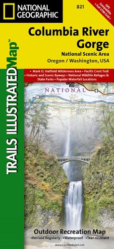
• Waterproof • Tear-Resistant • Topographic MapThe magnificent Multnomah Falls is just one of many natural, cultural, and recreational attractions in the Columbia River Gorge Scenic Area. The 80-mile-long gorge contains diverse ecosystems ranging from the lush Oneonta Gorge Rain Forest to the arid Celilo Grasslands. Expertly researched and created in partnership with local land management agencies, National Geographic's Trails Illustrated map of Columbia River Gorge provides an unparalleled tool for exploring this breathtaking region. Some of the key areas of interest featured on the map include the White Salmon, Klickitat, Sandy, and Lower Deschutes rivers; Yacolt Burn State Forest; Maryhill, Columbia Hills, and Rooster Rock state parks; Mark O. Hatfield Wilderness; and portions of Mount Hood and Gifford-Pinchot national forests. With miles of clearly marked trails including the Pacific Crest National Trail and the Oregon National Historic Trail, and such scenic roadways as the Historic Columbia River Highway and Yakima Scenic Byway, this map will prove invaluable whether you're taking in the scenery on foot or by car. A helpful list of waterfalls makes it easy to take in these natural wonders in your travels. Many recreation features are noted as well, including campgrounds, trailheads, interpretive trails, boat launches, and areas for fishing, windsurfing, and swimming. The map base includes contour lines and elevations for summits. Every Trails Illustrated map is printed on 'Backcountry Tough' waterproof, tear-resistant paper. A full UTM grid is printed on the map to aid with GPS navigation.Other features found on this map include: Bonneville Dam, Bull Run Reservoir Number One, Camas, Columbia Hills, Deschutes River, Gifford Pinchot National Forest, Gresham, Hood River, Klickitat River, Lake Celilo, Mark O. Hatfield Wilderness, Mount Defiance, Mt. Hood National Forest, Multnomah Falls, Shellrock Mountain, The Dalles, Troutdale, Washougal, White Salmon River.
DELIVERY & RETURNS
UK Delivery:
- Free delivery on all orders of £10 or more.
- £1.49 delivery fee on orders below £10.
- UK orders are shipped via Royal Mail 2nd Class.
International Delivery:
- Flat rate delivery charges vary by country.
Dispatch and Delivery Times:
- All orders are shipped from our warehouse in Northampton, UK within 48 hours of receipt during working hours.
- UK mainland orders typically arrive within 3-5 working days via Royal Mail 2nd Class.
- International estimated delivery times:
- Europe & Channel Islands: 7 to 10 working days
- USA: 7 to 15 working days
- Rest of the World: 9 to 21 working days
View our full delivery infomation here.
-
OVER
2 MILLION PRODUCTS
-
60 MILLION CUSTOMERS
ACROSS 190 COUNTRIES
You might also like
Loading recommendations...