
White Mountain National Forest West Map (Franconia Notch
White Mountain National Forest West Map (Franconia Notch
Trails Illustrated Maps
Map
Couldn't load pickup availability
Join our rewards scheme and earn reward points on this purchase!
Earn points on this!
Sign in or Sign up!- Release Date: 01/01/2025
- Barcode: 9781566954655
- Genre: Science Nature & Math
- Sub-Genre: Atlases & Maps
- Imprint: National Geographic
White Mountain National Forest West Map (Franconia Notch
Standard Edition
Couldn't load pickup availability
Collapsible content
DESCRIPTION
Trails Illustrated Maps
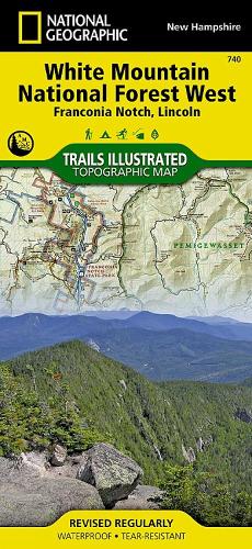
• Waterproof • Tear-Resistant • Topographic MapNational Geographic's Trails Illustrated map of White Mountain National Forest West provides unparalleled detail for outdoor enthusiasts seeking to enjoy the year-round recreational opportunities the park has to offer. Expertly researched and created in partnership with local land management agencies including the Appalachian Mountain Club, this map includes helpful contact information, safety tips, and more. The map features many key areas of interest including Presidential Range-Dry, Pemigewasset and Sandwich Range Wilderness, Connecticut River and White Mountain Trail Scenic Byways, Kancamagus Highway, Appalachian Trail, Squam Lake and Mount Washington.This map will prove invaluable in your exploration of the park, with its clearly marked trails, including miles of the Appalachian Trail that traverses the forest. All the trails are marked with mileage indicators, lookout points, shelters and other significant points of interest. The map base includes contour lines and elevations for summits, passes and many lakes. With many scenic byways noted, the map can guide those wishing to take in the scenery by car. Recreation features are clearly marked as well, including campgrounds, trailheads, interpretive trails, skiing, fishing, boating and swimming areas, waterfalls, scenic overlooks, and more. Every Trails Illustrated map is printed on 'Backcountry Tough' waterproof, tear-resistant paper. A full UTM grid is printed on the map to aid with GPS navigation.Other features found on this map include: Hanover, Knox Mountain, Montalban Ridge, Moose Mountain, Mount Franklin, Mount Lafayette, Mount Lincoln, Mount Monroe, Mount Moosilauke, Mount Tecumseh, Mount Washington, Ossipee Mountains, Pemigewasset Wilderness, Presidential Range, Presidential Range-Dry River Wilderness, Red Hill, Sandwich Range Wilderness, South Twin Mountain, Squam Lake, White Mountain National Forest, White Mountains.
DELIVERY & RETURNS
UK Delivery:
- Free delivery on all orders of £10 or more.
- £1.49 delivery fee on orders below £10.
- UK orders are shipped via Royal Mail 2nd Class.
International Delivery:
- Flat rate delivery charges vary by country.
Dispatch and Delivery Times:
- All orders are shipped from our warehouse in Northampton, UK within 48 hours of receipt during working hours.
- UK mainland orders typically arrive within 3-5 working days via Royal Mail 2nd Class.
- International estimated delivery times:
- Europe & Channel Islands: 7 to 10 working days
- USA: 7 to 15 working days
- Rest of the World: 9 to 21 working days
View our full delivery infomation here.
-
OVER
2 MILLION PRODUCTS
-
60 MILLION CUSTOMERS
ACROSS 190 COUNTRIES
You might also like
Loading recommendations...