
Glacier Bay National Park and Preserve Map
Glacier Bay National Park and Preserve Map
Trails Illustrated Maps
Map
Couldn't load pickup availability
Join our rewards scheme and earn reward points on this purchase!
Earn points on this!
Sign in or Sign up!- Release Date: 02/08/2012
- Barcode: 9781566953863
- Genre: Science Nature & Math
- Sub-Genre: Atlases & Maps
- Imprint: National Geographic
Glacier Bay National Park and Preserve Map
Standard Edition
Couldn't load pickup availability
Collapsible content
DESCRIPTION
Trails Illustrated Maps
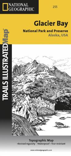
• Waterproof • Tear-Resistant • Topographic MapNational Geographic's Trails Illustrated map of Glacier Bay National Park and Preserve in Alaska's panhandle is perfect for hiking, camping, boating, paddling, and wildlife viewing in this scenic, rugged frontier. Created in partnership with local land management agencies, this expertly researched map delivers unmatched detail and helpful information for experienced outdoor enthusiasts and casual visitors alike. Some of the key areas of interest covered include Glacier Bay Wilderness, portions of Tongass National Forest, Chicagof Island, Endicott River Wilderness, Chilkat State Park, Chilkat Islands, Sullivan Island State Marine Park, Pleasant Island, Lemesurier Island, Inian Islands, and Tatshenshini Alsek Park. Waterways include the Gulf of Alaska; Glacier, Tituya, Berners, Tidal, Scidmore, and Taylor bays; Cross Sound; Icy Strait; Lynn Canal; North Passage; and Geikie, Muir, Tarr, Chilkoot, Chilkat, Wachusett, Queen, and Rendu inlets. The print version of this map contains detailed insets of Tarr and Johns Hopkins inlets, Gustavus, and Lamplugh Glacier.Transportation in Glacier Bay's wilderness can be challenging, but you'll find the information you need on this map with an accurate road network, ferries, boat ramps, harbors and anchorages, seaplane bases, seaplane anchorages, airports, and landing strips. In addition to contour lines, shaded relief, and summit elevations, this map highlights the many waterways with bathymetry, depths, and navigational aids. A handy distance chart will help you plan your outings. Many recreation features and facilities are noted as well, including hiking trails, campgrounds, picnic areas, rental cabins, lodging, boat fueling stations, ranger stations, and scenic byways.Every Trails Illustrated map is printed on 'Backcountry Tough' waterproof, tear-resistant paper. A full UTM grid is printed on the map to aid with GPS navigation.Other features found on this map include: Alsek Glacier, Alsek River, Brady Glacier, Cape Fairweather, Cape Spencer, Carroll Glacier, Casement Glacier, Chilkat Lake, Chilkat Range, Chilkat River, Cross Sound, Endicott River Wilderness, Fairweather Range, Glacier Bay, Glacier Bay National Park, Glacier Bay National Preserve, Grand Plateau Glacier, Icy Point, Icy Strait, Johns Hopkins Inlet, La Chaussee Spit, Muir Glacier, Muir Inlet, Novatak Glacier, Palma Bay, Plateau Glacier, Pleasant Island, Pleasant/Lemusurier/Inian Islands Wilderness, Tarr Inlet, Tongass National Forest.
DELIVERY & RETURNS
UK Delivery:
- Free delivery on all orders of £10 or more.
- £1.49 delivery fee on orders below £10.
- UK orders are shipped via Royal Mail 2nd Class.
International Delivery:
- Flat rate delivery charges vary by country.
Dispatch and Delivery Times:
- All orders are shipped from our warehouse in Northampton, UK within 48 hours of receipt during working hours.
- UK mainland orders typically arrive within 3-5 working days via Royal Mail 2nd Class.
- International estimated delivery times:
- Europe & Channel Islands: 7 to 10 working days
- USA: 7 to 15 working days
- Rest of the World: 9 to 21 working days
View our full delivery infomation here.
-
OVER
2 MILLION PRODUCTS
-
60 MILLION CUSTOMERS
ACROSS 190 COUNTRIES
You might also like
Loading recommendations...