
Hawaii Volcanoes National Park Map
Hawaii Volcanoes National Park Map
Trails Illustrated Maps
Map
Couldn't load pickup availability
Join our rewards scheme and earn reward points on this purchase!
Earn points on this!
Sign in or Sign up!- Release Date: 02/08/2012
- Barcode: 9781566953290
- Genre: Science Nature & Math
- Sub-Genre: Atlases & Maps
- Imprint: National Geographic
Hawaii Volcanoes National Park Map
Standard Edition
Couldn't load pickup availability
Collapsible content
DESCRIPTION
Trails Illustrated Maps
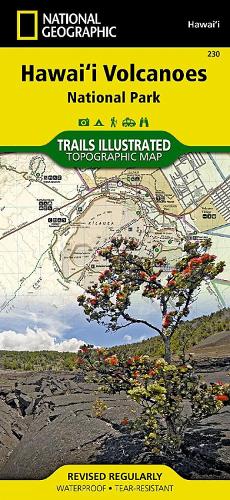
• Waterproof • Tear-Resistant • Topographic MapThere is perhaps no better place to witness the awesome volcanic activity of our planet than Hawaii Volcanoes National Park. The park was created to preserve the natural setting of Kilauea, one of the world's most active volcanoes, and Mauna Loa, the world's most massive subaerial volcano. The park is also refuge for many native plants and animals. National Geographic's Trails Illustrated map of Hawaii Volcanoes National Park combines unmatched detail with helpful information to offer an invaluable tool for making the most of your visit to this extraordinary landscape. Created in partnership with local land management agencies, this expertly researched map features key areas of interest including Makaopuhi Crater, Napau Crater, Chain of Craters Road, Kapapala, and Pu'u Loa. The print version of this map also includes a detailed inset of Kilauea Caldera.Designed with a wide range of visitors in mind, this map features detailed and easy to read trails that are clearly marked according to use and include mileage between intersections. A handy day hike chart with length, time, and descriptions of each hike will help you choose a trail that's right for you. Road types are differentiated as well, so you know if the route you choose is a paved, four-wheel-drive, or high-clearance road. Recreation features and amenities are clearly marked, including campgrounds, trailheads, interpretive trails, picnic areas, scenic overlooks, points of interest, restrooms, lodging, and food services. The map base includes contour lines and elevations for summits.Every Trails Illustrated map is printed on 'Backcountry Tough' waterproof, tear-resistant paper. A full UTM grid is printed on the map to aid with GPS navigation.Other features found on this map include: Hawai'i Volcanoes National Park, Island of Hawaii, Kau Desert, Kilauea Crater, Mauna Loa.
DELIVERY & RETURNS
UK Delivery:
- Free delivery on all orders of £10 or more.
- £1.49 delivery fee on orders below £10.
- UK orders are shipped via Royal Mail 2nd Class.
International Delivery:
- Flat rate delivery charges vary by country.
Dispatch and Delivery Times:
- All orders are shipped from our warehouse in Northampton, UK within 48 hours of receipt during working hours.
- UK mainland orders typically arrive within 3-5 working days via Royal Mail 2nd Class.
- International estimated delivery times:
- Europe & Channel Islands: 7 to 10 working days
- USA: 7 to 15 working days
- Rest of the World: 9 to 21 working days
View our full delivery infomation here.
-
OVER
2 MILLION PRODUCTS
-
60 MILLION CUSTOMERS
ACROSS 190 COUNTRIES
You might also like
Loading recommendations...