
Pagosa Springs, Bayfield Map
Pagosa Springs, Bayfield Map
Trails Illustrated Maps
Map
Couldn't load pickup availability
Join our rewards scheme and earn reward points on this purchase!
Earn points on this!
Sign in or Sign up!- Release Date: 02/08/2012
- Barcode: 9781566952392
- Genre: Science Nature & Math
- Sub-Genre: Atlases & Maps
- Imprint: National Geographic
Pagosa Springs, Bayfield Map
Reprint
Couldn't load pickup availability
Collapsible content
DESCRIPTION
Trails Illustrated Maps
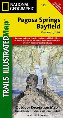
• Waterproof • Tear-Resistant • Topographic MapNational Geographic's Trails Illustrated map of Pagosa Springs and Bayfield provides unparalleled detail of this area on the western slope of the Continental Divide in southwestern Colorado. Expertly researched and created in partnership with the U.S. Forest Service, Southern Ute Indian Tribe, Bureau of Land Management and others, the map's coverage includes San Juan National Forest, Piedra Area and River, Vallecito and Lemon Reservoirs, Chimney Rock National Monument and Southern Ute Indian Reservation.Get off the beaten path and back on again by following the map to trailheads and then along trails that are labeled according to their designated usage. High clearance and four-wheel drive roads are marked as well. To aid in your navigation, the map includes contour lines, elevations, labeled peaks, water features, waypoints, and clear boundaries between national park and Indian land, which is closed to the public for recreational purposes. Many recreation points of interest, for all seasons, are clearly noted, including campgrounds and campsites, cross-country ski areas and snowmobile trails, boat launch and river access points, fishing areas, scenic viewpoints and wildlife viewing areas. In addition, the map provides background information of the area, survival tips and contact information of both public and private organizations involved in maintaining the region. Every Trails Illustrated map is printed on 'Backcountry Tough' waterproof, tear-resistant paper. A full UTM grid is printed on the map to aid with GPS navigation.Other features found on this map include: Mesa Mountains, Navajo River, San Juan National Forest, Vallecito Reservoir, Weminuche Wilderness.
DELIVERY & RETURNS
UK Delivery:
- Free delivery on all orders of £10 or more.
- £1.49 delivery fee on orders below £10.
- UK orders are shipped via Royal Mail 2nd Class.
International Delivery:
- Flat rate delivery charges vary by country.
Dispatch and Delivery Times:
- All orders are shipped from our warehouse in Northampton, UK within 48 hours of receipt during working hours.
- UK mainland orders typically arrive within 3-5 working days via Royal Mail 2nd Class.
- International estimated delivery times:
- Europe & Channel Islands: 7 to 10 working days
- USA: 7 to 15 working days
- Rest of the World: 9 to 21 working days
View our full delivery infomation here.
-
OVER
2 MILLION PRODUCTS
-
60 MILLION CUSTOMERS
ACROSS 190 COUNTRIES
You might also like
Loading recommendations...