
2025 Collins Road Map of Britain
2025 Collins Road Map of Britain
Map
Couldn't load pickup availability
Join our rewards scheme and earn reward points on this purchase!
Earn points on this!
Sign in or Sign up!- Release Date: 14/03/2024
- Barcode: 9780008652913
- Genre: Travel & Transport
- Subgenre: Atlases & Maps
2025 Collins Road Map of Britain
Couldn't load pickup availability
Collapsible content
DESCRIPTION
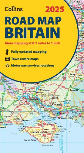
Folded Map Full-colour, double-sided road map of Great Britain at a scale of 8.7 miles to 1 inch. Northern England, Scotland and the Isle of Man are on one side with Southern England and Wales on the other. With its easily identifiable counties and unitary authorities,this map is ideal for business users but it is also perfect for tourists for route planning. Main features:
Explore Britain with easy-to-read mapping from Collins.
Explore Britain with easy-to-read mapping from Collins.
DELIVERY & RETURNS
UK Delivery:
- Free delivery on all orders of £10 or more.
- £1.49 delivery fee on orders below £10.
- UK orders are shipped via Royal Mail 2nd Class.
International Delivery:
- Flat rate delivery charges vary by country.
Dispatch and Delivery Times:
- All orders are shipped from our warehouse in Northampton, UK within 48 hours of receipt during working hours.
- UK mainland orders typically arrive within 3-5 working days via Royal Mail 2nd Class.
- International estimated delivery times:
- Europe & Channel Islands: 7 to 10 working days
- USA: 7 to 15 working days
- Rest of the World: 9 to 21 working days
View our full delivery infomation here.
-
OVER
2 MILLION PRODUCTS
-
60 MILLION CUSTOMERS
ACROSS 190 COUNTRIES
You might also like
Loading recommendations...