
Appalachian Trail: Vermont, New Hampshire (Map Pack)
Appalachian Trail: Vermont, New Hampshire (Map Pack)
Topographic Map Guides
Map
Couldn't load pickup availability
Join our rewards scheme and earn reward points on this purchase!
Earn points on this!
Sign in or Sign up!- Release Date: 09/01/2020
- Barcode: 9781566958417
- Genre: Non-Fiction
- Sub-Genre: Sports & Hobbies
- Imprint: National Geographic
Appalachian Trail: Vermont, New Hampshire (Map Pack)
Standard Edition
Couldn't load pickup availability
Collapsible content
DESCRIPTION
Topographic Map Guides
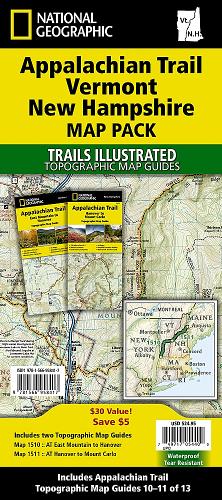
• Waterproof • Tear-Resistant • Topographic MapsThe Appalachian Trail (AT) Map Pack of Vermont, New Hampshire includes two Topographic Map Guides that cover the AT in these two very distinct states. The landscape of Vermont is a variety of wooded mountains, forests of white pine and paper birch, and rolling terrain dotted by fields and pastures. To the north and east, the AT crosses short, steep hills and overgrown farmlands that characterize the Connecticut River valley. Farther south is the rugged and rocky high country of the Green Mountains. The AT through New Hampshire is considered one of the more challenging sections of the trail, with long stretches above tree line and the possibility for rapid temperature change and snow any month of the year. But despite its difficulty, the trail offers some of the most spectacular scenery in New England as it leaves the Connecticut River valley to traverse the beautifully rugged White Mountains, a highlight of the AT.Each AT Topographic Map Guide includes detailed topographic maps at a detail of 1 inch = 1 mile. Each page is centered on the A.T. and overlaps with the adjacent pages so there is little chance of getting lost. Along the bottom of each page is a trail profile that shows the distance between shelters, camping areas, and trail access points. The map and trail profile provide a step by step visual guide to hiking the trail, mile by rugged mile. The Topographic Map Guide is built for all levels of hiking enthusiasts, from the day tripper to the multi month 'thru-hiker'. The front pages of the printed Topographic Map Guide include resupply information, town inset maps, camping options, and much more.Buy the Map Pack and save over 15%!The Appalachian Trail: Vermont, New Hampshire [Map Pack] includes: • Map 1510 :: East Mountain to Hanover [Vermont] • Map 1511 :: Hanover to Mount Carlo [New Hampshire]More convenient and easier to use than folded maps, but just as compact and lightweight, National Geographic's Topographic Map Guide booklets are printed on 'Backcountry Tough' waterproof, tear-resistant paper with stainless steel staples. A full UTM grid is printed on the map to aid with GPS navigation.
DELIVERY & RETURNS
UK Delivery:
- Free delivery on all orders of £10 or more.
- £1.49 delivery fee on orders below £10.
- UK orders are shipped via Royal Mail 2nd Class.
International Delivery:
- Flat rate delivery charges vary by country.
Dispatch and Delivery Times:
- All orders are shipped from our warehouse in Northampton, UK within 48 hours of receipt during working hours.
- UK mainland orders typically arrive within 3-5 working days via Royal Mail 2nd Class.
- International estimated delivery times:
- Europe & Channel Islands: 7 to 10 working days
- USA: 7 to 15 working days
- Rest of the World: 9 to 21 working days
View our full delivery infomation here.
-
OVER
2 MILLION PRODUCTS
-
60 MILLION CUSTOMERS
ACROSS 190 COUNTRIES
You might also like
Loading recommendations...