
Colorado Trail, Collegiate Loop Map
Colorado Trail, Collegiate Loop Map
Topographic Map Guides
Map
Couldn't load pickup availability
Join our rewards scheme and earn reward points on this purchase!
Earn points on this!
Sign in or Sign up!- Release Date: 07/06/2017
- Barcode: 9781566957229
- Genre: Sports & Hobbies
- Sub-Genre: Travel Guides
- Imprint: National Geographic
Colorado Trail, Collegiate Loop Map
Standard Edition
Couldn't load pickup availability
Collapsible content
DESCRIPTION
Topographic Map Guides
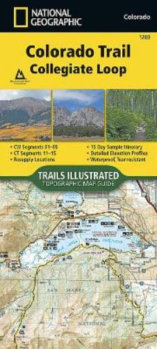
• Waterproof • Tear-Resistant • Topographic MapThe Colorado Trail, Collegiate Loop Topographic Map Guide has been designed as the perfect traveling companion when navigating the Collegiate Loop section of The Colorado Trail. In 2012, the 83-mile Collegiate West route was added to The Colorado Trail as an alternate route to the Collegiate East section, creating the approximately 163-mile Collegiate Loop.The Collegiate Loop Topographic Map Guide starts at the top end of the loop near Twin Lakes Reservoir. The trail tracks south along the eastern slope of Sawatch Range under the watchful gaze of several 14ers (fourteen-thousand foot peaks) until it joins the Continental Divide Trail near Monarch. The trail then turns north along the west side of the Sawatch Range as it crisscrosses the continental divide until finally finishing the loop back at Twin Lakes Reservoir. Each page is centered on the trail and overlaps with adjacent pages so there is little chance of getting lost. Along the bottom of each page is a trail profile that shows the distance between passes, camping areas, and trail access points. The map and trail profile provide a step by step visual guide to hiking the trail, mile by rugged mile.Expertly researched and created in partnership with local land management agencies including The Colorado Trail Foundation, this map guide provides detailed topographic maps, interesting history, a 15 day itinerary, and a resupply location chart shows distances, and services available at each resupply point.More convenient and easier to use than folded maps, but just as compact and lightweight, National Geographic's Topographic Map Guide booklets are printed on 'Backcountry Tough' waterproof, tear-resistant paper with stainless steel staples. A full UTM grid is printed on the map to aid with GPS navigation.
DELIVERY & RETURNS
UK Delivery:
- Free delivery on all orders of £10 or more.
- £1.49 delivery fee on orders below £10.
- UK orders are shipped via Royal Mail 2nd Class.
International Delivery:
- Flat rate delivery charges vary by country.
Dispatch and Delivery Times:
- All orders are shipped from our warehouse in Northampton, UK within 48 hours of receipt during working hours.
- UK mainland orders typically arrive within 3-5 working days via Royal Mail 2nd Class.
- International estimated delivery times:
- Europe & Channel Islands: 7 to 10 working days
- USA: 7 to 15 working days
- Rest of the World: 9 to 21 working days
View our full delivery infomation here.
-
OVER
2 MILLION PRODUCTS
-
60 MILLION CUSTOMERS
ACROSS 190 COUNTRIES
You might also like
Loading recommendations...