
Bradshaw Mountains Map
Bradshaw Mountains Map
Trails Illustrated Maps
Map
Couldn't load pickup availability
Join our rewards scheme and earn reward points on this purchase!
Earn points on this!
Sign in or Sign up!- Release Date: 02/08/2012
- Barcode: 9781566955171
- Genre: Science Nature & Math
- Sub-Genre: Atlases & Maps
- Imprint: National Geographic
Bradshaw Mountains Map
Standard Edition
Couldn't load pickup availability
Collapsible content
DESCRIPTION
Trails Illustrated Maps
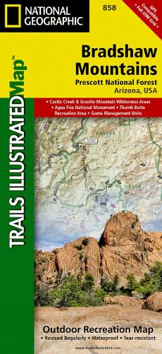
• Waterproof • Tear-Resistant • Topographic MapCreated in partnership with the U.S. Forest Service and others, National Geographic's Trails Illustrated Map of Bradshaw Mountains is an essential travel companion for novice and experienced outdoor enthusiasts alike exploring the area. Recreational lands around Prescott are shown with unparalleled detail in this expertly researched map. Coverage includes Prescott National Forest, Granite Mountain and Castle Creek Wilderness areas, Agua Fria National Monument, Hayfield Draw and Alto Pitt OHV Areas, Lynx Lake and a small segment of the Verde Wild and Scenic River as well as the municipalities of Prescott and Prescott Valley.Get off the beaten path and back on by following along the clearly mapped trails, colored for motorized or non-motorized use, including the Great Western Trail, which is highlighted. ATVers will find designated recreation areas and trails marked. Navigate the area aided by the map's contour lines, elevations, labeled peaks and summits, water features, areas of wooded cover, numbered Forest Service roads, selected waypoints and color-coded boundaries between different land management agencies as well as complete road network of the region. Some other recreation features pinpointed are campgrounds, interpretive trails, trailheads, picnic areas, rental cabins, river access point, boat launches, observation points and lookout towers. Background information of the recreation areas is provided along with safety tips and essential contact information. Every Trails Illustrated map is printed on 'Backcountry Tough' waterproof, tear-resistant paper. A full UTM grid is printed on the map to aid with GPS navigation.Other features found on this map include: Bradshaw Mountains, Castle Creek Wilderness, Granite Mountain, Granite Mountain (AZ) Wilderness, Prescott, Prescott National Forest, Prescott Valley, Tonto National Forest, Weaver Mountains.
DELIVERY & RETURNS
UK Delivery:
- Free delivery on all orders of £10 or more.
- £1.49 delivery fee on orders below £10.
- UK orders are shipped via Royal Mail 2nd Class.
International Delivery:
- Flat rate delivery charges vary by country.
Dispatch and Delivery Times:
- All orders are shipped from our warehouse in Northampton, UK within 48 hours of receipt during working hours.
- UK mainland orders typically arrive within 3-5 working days via Royal Mail 2nd Class.
- International estimated delivery times:
- Europe & Channel Islands: 7 to 10 working days
- USA: 7 to 15 working days
- Rest of the World: 9 to 21 working days
View our full delivery infomation here.
-
OVER
2 MILLION PRODUCTS
-
60 MILLION CUSTOMERS
ACROSS 190 COUNTRIES
You might also like
Loading recommendations...