
Prince William Sound West Map
Prince William Sound West Map
Trails Illustrated Maps
Map
Couldn't load pickup availability
Join our rewards scheme and earn reward points on this purchase!
Earn points on this!
Sign in or Sign up!- Release Date: 01/01/2008
- Barcode: 9781566954204
- Genre: Science Nature & Math
- Sub-Genre: Atlases & Maps
- Imprint: National Geographic
Prince William Sound West Map
Standard Edition
Couldn't load pickup availability
Collapsible content
DESCRIPTION
Trails Illustrated Maps
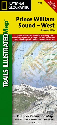
• Waterproof • Tear-Resistant • Topographic MapPrince William Sound is a dramatic marine landscape of endless coastline, rugged mountains, and tidewater glaciers known for calving enormous chunks of ice into the sea. Expertly researched and created in partnership with local land management agencies, National Geographic's Trails Illustrated map of Prince William Sound - West provides an unparalleled tool for exploring this breathtaking region. Key areas of interest include Whittier, Port Nellie Juan, Chugach National Forest, Nellie Juan-College Fiord Wilderness Study Area, and Harriman, Blue, and College fiords. Chenega, Knight, Latouche, Elrington, Evans, Bainbridge, Culross, Esther, and Perry islands are also shown.Kayaking and boating are popular activities in Prince William Sound and state marine parks abound including South Esther Island, Granite Bay, Bettles Bay, Surprise Cove, Decision Point, Entry Cove, Ziegler Cove, Thumb Cove, Safety Cove, Sandspit Point, Sunny Cove, Driftwood Bay, and Horseshoe Bay. The map features detailed topography with shaded relief and contour lines; clearly defined, color-coded boundaries of state marine parks, wildlife areas, and native corporation lands; safety information; elevations for summits, passes, and some lakes; and depth soundings. Recreation features are clearly marked, including campgrounds, public use cabins, kayak landings, seaplane bases, selected anchorages, trailheads, and lighthouses.Every Trails Illustrated map is printed on 'Backcountry Tough' waterproof, tear-resistant paper. A full UTM grid is printed on the map to aid with GPS navigation.Other features found on this map include: Blying Sound, Cape Junken, Chugach National Forest, College Fiord, Day Harbor, Ellsworth Glacier, Inner Lake George, Kings Bay, Knight Island, Knight Island Passage, Knik Glacier, Montague Strait, Nellie Juan River, Perry Island, Port Bainbridge, Port Wells, Sargent Icefield, Unakwik Inlet, Upper Lake George.
DELIVERY & RETURNS
UK Delivery:
- Free delivery on all orders of £10 or more.
- £1.49 delivery fee on orders below £10.
- UK orders are shipped via Royal Mail 2nd Class.
International Delivery:
- Flat rate delivery charges vary by country.
Dispatch and Delivery Times:
- All orders are shipped from our warehouse in Northampton, UK within 48 hours of receipt during working hours.
- UK mainland orders typically arrive within 3-5 working days via Royal Mail 2nd Class.
- International estimated delivery times:
- Europe & Channel Islands: 7 to 10 working days
- USA: 7 to 15 working days
- Rest of the World: 9 to 21 working days
View our full delivery infomation here.
-
OVER
2 MILLION PRODUCTS
-
60 MILLION CUSTOMERS
ACROSS 190 COUNTRIES
You might also like
Loading recommendations...