
Black Canyon of the Gunnison National Park Map
Black Canyon of the Gunnison National Park Map
Trails Illustrated Maps
Map
Couldn't load pickup availability
Join our rewards scheme and earn reward points on this purchase!
Earn points on this!
Sign in or Sign up!- Release Date: 02/08/2012
- Barcode: 9781566953689
- Genre: Science Nature & Math
- Sub-Genre: Atlases & Maps
- Imprint: National Geographic
Black Canyon of the Gunnison National Park Map
Reprint
Couldn't load pickup availability
Collapsible content
DESCRIPTION
Trails Illustrated Maps
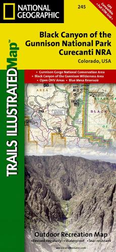
• Waterproof • Tear-Resistant • Topographic MapThe Black Canyon, 48 miles of awe-inspiring, steep-walled canyon carved by the Gunnison River, has been an obstacle and attraction to residents and visitors alike for centuries. National Geographic's Trails Illustrated map of Black Canyon of the Gunnison National Park and Curecanti National Recreation Area delivers unmatched detail and valuable information to assist you in your exploration of this breathtaking wilderness. Expertly researched and created in partnership with local land management agencies, this map includes Gunnison Gorge National Conservation Area; Blue Mesa Reservoir; portions of Gunnison National Forest and West Elk Wilderness; and the towns of Montrose, Paonia, and Hotchkiss.Designed with a wide range of visitors in mind, this map features detailed and easy-to-read trails, accurate road network, and a variety of information about the region and recreational activities available, including hiking trail summaries for the north and south rims of the canyon. Trail use is easy to identify, whether you're traveling on foot, horse, OHV, or snowmobile. Road types are differentiated as well, so you know if the route you choose is a four-wheel-drive or high-clearance road. The West Elk Loop and Silver Thread scenic byways are noted for those wishing to take in the scenery by car. Campgrounds, fishing areas, boat ramps, river access, and primitive campsites for hikers and boaters throughout the park are shown, as well as rapids and ratings along the Gunnison River. The map base includes contour lines and elevations for summits, passes and many lakes.Every Trails Illustrated map is printed on 'Backcountry Tough' waterproof, tear-resistant paper. A full UTM grid is printed on the map to aid with GPS navigation.Other features found on this map include: Black Canyon of the Gunnison, Black Canyon of the Gunnison National Park, Blue Mesa Reservoir, Curecanti, Gunnison National Forest, Montrose, Uncompahgre National Forest, West Elk Wilderness.
DELIVERY & RETURNS
UK Delivery:
- Free delivery on all orders of £10 or more.
- £1.49 delivery fee on orders below £10.
- UK orders are shipped via Royal Mail 2nd Class.
International Delivery:
- Flat rate delivery charges vary by country.
Dispatch and Delivery Times:
- All orders are shipped from our warehouse in Northampton, UK within 48 hours of receipt during working hours.
- UK mainland orders typically arrive within 3-5 working days via Royal Mail 2nd Class.
- International estimated delivery times:
- Europe & Channel Islands: 7 to 10 working days
- USA: 7 to 15 working days
- Rest of the World: 9 to 21 working days
View our full delivery infomation here.
-
OVER
2 MILLION PRODUCTS
-
60 MILLION CUSTOMERS
ACROSS 190 COUNTRIES
You might also like
Loading recommendations...