
Leadville, Fairplay Map
Leadville, Fairplay Map
Trails Illustrated Maps
Map
Couldn't load pickup availability
Join our rewards scheme and earn reward points on this purchase!
Earn points on this!
Sign in or Sign up!- Release Date: 02/08/2012
- Barcode: 9781566953641
- Genre: Science Nature & Math
- Sub-Genre: Atlases & Maps
- Imprint: National Geographic
Leadville, Fairplay Map
Standard Edition
Couldn't load pickup availability
Collapsible content
DESCRIPTION
Trails Illustrated Maps
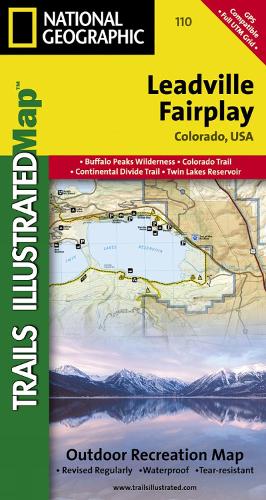
• Waterproof • Tear-Resistant • Topographic MapNestled in a high mountain valley surrounded by snowcapped peaks, former mining town Leadville, Colorado is the highest incorporated city in the United States. National Geographic's Trails Illustrated map of Leadville and Fairplay is designed to meet the needs of outdoor enthusiasts by combining valuable information with unmatched detail of this popular destination for year-round recreation. Created in partnership with local land management agencies, this expertly researched map features key areas of interest including Twin Lakes and Clear Creek reservoirs; Arkansas River; Mount Massive Lakes; and portions of the Top of the Rockies and Collegiate Peaks scenic byways.With miles of clearly marked trails including portions of the Colorado and Continental Divide trails, this map will prove invaluable in your exploration of the region. Trail mileage between intersections will help you choose the path that's right for you. Cyclists will appreciate the detail paid to the many paved and mountain bike trails in the region. Cross country ski, snowmobile, and motorized trails are included as well. Road types are differentiated, so you know if the route you choose is a four-wheel-drive or high-clearance road. The map base includes contour lines and elevations for summits and passes. Recreation features are clearly marked, including campgrounds, trailheads, river access, fishing areas, boat launches, and more.Every Trails Illustrated map is printed on 'Backcountry Tough' waterproof, tear-resistant paper. A full UTM grid is printed on the map to aid with GPS navigation.Other features found on this map include: Buffalo Peaks Wilderness, Mosquito Range, Mount Sherman, Pike National Forest, San Isabel National Forest.
DELIVERY & RETURNS
UK Delivery:
- Free delivery on all orders of £10 or more.
- £1.49 delivery fee on orders below £10.
- UK orders are shipped via Royal Mail 2nd Class.
International Delivery:
- Flat rate delivery charges vary by country.
Dispatch and Delivery Times:
- All orders are shipped from our warehouse in Northampton, UK within 48 hours of receipt during working hours.
- UK mainland orders typically arrive within 3-5 working days via Royal Mail 2nd Class.
- International estimated delivery times:
- Europe & Channel Islands: 7 to 10 working days
- USA: 7 to 15 working days
- Rest of the World: 9 to 21 working days
View our full delivery infomation here.
-
OVER
2 MILLION PRODUCTS
-
60 MILLION CUSTOMERS
ACROSS 190 COUNTRIES
You might also like
Loading recommendations...