
Vail, Frisco, Dillon Map
Vail, Frisco, Dillon Map
Trails Illustrated Maps
Map
Couldn't load pickup availability
Join our rewards scheme and earn reward points on this purchase!
Earn points on this!
Sign in or Sign up!- Release Date: 02/08/2012
- Barcode: 9781566952811
- Genre: Science Nature & Math
- Sub-Genre: Atlases & Maps
- Imprint: National Geographic
Vail, Frisco, Dillon Map
Standard Edition
Couldn't load pickup availability
Collapsible content
DESCRIPTION
Trails Illustrated Maps
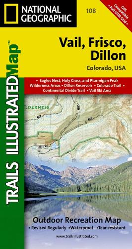
• Waterproof • Tear-Resistant • Topographic MapThough best known for winter sports, Vail and its neighboring communities are popular destinations for year-round outdoor recreation. National Geographic's Trails Illustrated map of Vail, Frisco, and Dillon is an unparalleled tool for exploring this region of the Colorado Rockies. Created in partnership with local land management agencies, this expertly researched map delivers unmatched detail and helpful information for experienced outdoor enthusiasts and casual visitors alike. Key areas of interest featured on this map include Dillon Reservoir, Silverthorne, Black Lakes and Blue River state wildlife areas, Eagle River, and Vail Ski Area.This map can guide you off the beaten path and back again with miles of mapped trails including portions of the Colorado and Continental Divide trails, as well as Vail Pass/Tenmile Canyon and Two Elk national recreation trails. The clearly marked trails include mileages between intersections. Trail use is easy to identify, whether you're hiking, biking, snowmobiling, or cross-country skiing. Road types are differentiated as well, so you know if the route you choose is a four-wheel-drive or high-clearance road. The Top of the Rockies Scenic Byway is noted for those wishing to take in the scenery by car. Recreation features are clearly marked, including campgrounds, trailheads, fishing areas, boat launches, 10th Mountain Division huts, and more. The map base includes contour lines and elevations for summits, passes and many lakes.Every Trails Illustrated map is printed on 'Backcountry Tough' waterproof, tear-resistant paper. A full UTM grid is printed on the map to aid with GPS navigation.Other features found on this map include: Arapaho National Forest, Dillon Reservoir, Eagles Nest Wilderness, Holy Cross Wilderness, Ptarmigan Peak Wilderness, White River National Forest.
DELIVERY & RETURNS
UK Delivery:
- Free delivery on all orders of £10 or more.
- £1.49 delivery fee on orders below £10.
- UK orders are shipped via Royal Mail 2nd Class.
International Delivery:
- Flat rate delivery charges vary by country.
Dispatch and Delivery Times:
- All orders are shipped from our warehouse in Northampton, UK within 48 hours of receipt during working hours.
- UK mainland orders typically arrive within 3-5 working days via Royal Mail 2nd Class.
- International estimated delivery times:
- Europe & Channel Islands: 7 to 10 working days
- USA: 7 to 15 working days
- Rest of the World: 9 to 21 working days
View our full delivery infomation here.
-
OVER
2 MILLION PRODUCTS
-
60 MILLION CUSTOMERS
ACROSS 190 COUNTRIES
You might also like
Loading recommendations...