Fischbacher Alps, Walking-, Bike- and Leisure m...

Fischbacher Alps, Walking-, Bike- and Leisure map 1:50.000,
Fischbacher Alps, Walking-, Bike- and Leisure map 1:50.000,
Map
Couldn't load pickup availability
Join our rewards scheme and earn reward points on this purchase!
Earn points on this!
Sign in or Sign up!- Release Date: 12/07/2021
- Barcode: 9783850847025
- Genre: Science Nature & Math
- Sub-Genre: Atlases & Maps
- Publisher: Freytag-Berndt
Fischbacher Alps, Walking-, Bike- and Leisure map 1:50.000,
Couldn't load pickup availability
Collapsible content
DESCRIPTION
freytag & berndt maps are available for many countries and regions in the world. In addition to the precise cartography each map also includes a lot of additional information about the region covered.
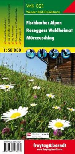
The freytag & berndt hiking map of the Fischbach Alps covers almost the entire mountain range on the ideal scale of 1:50,000. The densely wooded mountains and hilltops covered with pastures of the Fischbacher Alps extend between the Mürztal and the hilly Joglland and are ideal for long hikes without major alpine requirements. The region also offers the best conditions for cyclists and mountain bikers: be it the trails between Alpl and Stuhleck, the varied tour 'Der Große Jogl' or the 'Wexltrails' in the adjoining Wechsel area. Some smaller ski areas such as Hirschenkogel, Stuhleck or Hauereck also have a lot to offer for winter sports enthusiasts. The well-known area around 'Roseggers Waldheimat' bears the name of the famous poet Peter Rosegger, who immortalized his homeland in literature around the turn of the century. Information on the Fischbach Alps hiking map Hiking and long-distance hiking trails via ferratas Cycle paths, mountain bike trails Cross-country ski trails, ski routes Attractive excursion destination Scale 1:50,000 90 x 61 cm With booklet Supplement In addition to an overview of the region, the enclosed information brochure also contains tourist information and tips for the high-altitude health resort of Fischbach. Descriptions of the various long-distance hiking trails make you want to explore the Fischbach Alps and their surroundings. Our top hiking trails offer a selection of hiking suggestions and offer practical information, a description of the route and an elevation profile for each hike. There are also suggested routes for mountain bikers - the 'Der Große Jogl' cycle route, which is described in more detail, connects the wooded peaks of the Fischbacher Alps with the hills of the Joglland and is therefore certainly the highlight of the region. The Mürztalradweg and the Feistritztalradweg are ideal for leisurely cycling. A list of huts provides information on all refuges as well as mountain and excursion inns. Environment maps: WK 022, WK 0041, WK 131, WK 422.
DELIVERY & RETURNS
UK Delivery:
- Free delivery on all orders of £10 or more.
- £1.49 delivery fee on orders below £10.
- UK orders are shipped via Royal Mail 2nd Class.
International Delivery:
- Flat rate delivery charges vary by country.
Dispatch and Delivery Times:
- All orders are shipped from our warehouse in Northampton, UK within 48 hours of receipt during working hours.
- UK mainland orders typically arrive within 3-5 working days via Royal Mail 2nd Class.
- International estimated delivery times:
- Europe & Channel Islands: 7 to 10 working days
- USA: 7 to 15 working days
- Rest of the World: 9 to 21 working days
View our full delivery infomation here.
-
OVER
2 MILLION PRODUCTS
-
60 MILLION CUSTOMERS
ACROSS 190 COUNTRIES
You might also like
Loading recommendations...