
Wilseder Berg, hiking map
Wilseder Berg, hiking map
WKD2579
Map
Couldn't load pickup availability
Join our rewards scheme and earn reward points on this purchase!
Earn points on this!
Sign in or Sign up!- Release Date: 28/02/2022
- Barcode: 9783707920277
- Genre: Science Nature & Math
- Sub-Genre: Atlases & Maps
- Publisher: Freytag-Berndt
Wilseder Berg, hiking map
Couldn't load pickup availability
Collapsible content
DESCRIPTION
WKD2579
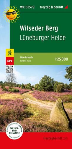
The hiking map presents the Lüneburg Heath Nature Park, which protects a cultural landscape that is five thousand years old.
The hiking map presents the Luneburg Heath Nature Park, which protects a cultural landscape that is five thousand years old. The car-free heath landscape, which is still cared for by Heidschnucken today, can be easily hiked with the help of the map. Around Bispingen alone there are seven hundred km of signposted cycling and hiking trails. Both long-distance and regional hiking trails are marked in the map section, which include the highest elevation in the region, the Wilseder Berg. Yellow flags indicate other tourist destinations such as the Heidegarten in Schneverdingen, the SnowDome near Bispingen or the natural adventure pool in Egestorf.
DELIVERY & RETURNS
UK Delivery:
- Free delivery on all orders of £10 or more.
- £1.49 delivery fee on orders below £10.
- UK orders are shipped via Royal Mail 2nd Class.
International Delivery:
- Flat rate delivery charges vary by country.
Dispatch and Delivery Times:
- All orders are shipped from our warehouse in Northampton, UK within 48 hours of receipt during working hours.
- UK mainland orders typically arrive within 3-5 working days via Royal Mail 2nd Class.
- International estimated delivery times:
- Europe & Channel Islands: 7 to 10 working days
- USA: 7 to 15 working days
- Rest of the World: 9 to 21 working days
View our full delivery infomation here.
-
OVER
2 MILLION PRODUCTS
-
60 MILLION CUSTOMERS
ACROSS 190 COUNTRIES
You might also like
Loading recommendations...