Appalachian Trail: Damascus to Bailey Gap Map (...

Appalachian Trail: Damascus to Bailey Gap Map (Virginia)
Appalachian Trail: Damascus to Bailey Gap Map (Virginia)
Topographic Map Guides
Map
Couldn't load pickup availability
Join our rewards scheme and earn reward points on this purchase!
Earn points on this!
Sign in or Sign up!- Release Date: 31/12/2015
- Barcode: 9781597756402
- Genre: Science Nature & Math
- Sub-Genre: Atlases & Maps
- Imprint: National Geographic
Appalachian Trail: Damascus to Bailey Gap Map (Virginia)
Standard Edition
Couldn't load pickup availability
Collapsible content
DESCRIPTION
Topographic Map Guides
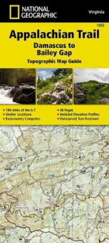
• Waterproof • Tear-Resistant • Topographic MapThe Damascus to Bailey Gap Topographic Map Guide makes a perfect traveling companion when traversing the southwest Virginia section of the Appalachian Trail (A.T.). The A.T. in southwest Virginia travels through a culturally and historically rich area that includes fertile farmland, long, wooded ridges, and the highest mountains in the state. While the Mt. Rogers high country, just east of Damascus, is very popular with visitors, hikers can find excellent opportunities for solitude farther north on their way to the New River and Bailey Gap.Each A.T. Topographic Map Guide includes detailed topographic maps at a detail of 1 inch = 1 mile. Each page is centered on the A.T. and overlaps with the adjacent pages so there is little chance of getting lost. Along the bottom of each page is a trail profile that shows the distance between shelters, camping areas, and trail access points. The map and trail profile provide a step by step visual guide to hiking the trail, mile by rugged mile. The Topographic Map Guide is built for all levels of hiking enthusiasts, from the day tripper to the multi month 'thru-hiker'. The front pages of the printed Topographic Map Guide include resupply information, town inset maps, camping options, and much more.Every Topographic Map Guide is printed on 'Backcountry Tough' waterproof, tear-resistant paper. A full UTM grid is printed on the map to aid with GPS navigation.Other features found on this map include: Abingdon Gap Shelter, Atkins, Bailey Gap Shelter, Bastian, Bland, Bluefield, Chatfield Shelter, Chestnut Knob Shelter, Damascus, Doc's Knob Shelter, Grayson Highlands State Park, Helveys Mill Shelter, Hurricane Mtn Shelter, Jefferson National Forest, Jenkins Shelter, Jenny Knob Shelter, Knot Maul Branch Shelter, Lost Mtn Shelter, Marion, Mount Rogers, Old Orchard Shelter, Partnership Shelter, Pearisburg, Pine Swamp Branch Shelter, Princeton, Rice Field Shelter, Saunders Shelter, Tazewell, Thomas Knob Shelter, Trimpi Shelter, Wapiti Shelter, Wise Shelter.
DELIVERY & RETURNS
UK Delivery:
- Free delivery on all orders of £10 or more.
- £1.49 delivery fee on orders below £10.
- UK orders are shipped via Royal Mail 2nd Class.
International Delivery:
- Flat rate delivery charges vary by country.
Dispatch and Delivery Times:
- All orders are shipped from our warehouse in Northampton, UK within 48 hours of receipt during working hours.
- UK mainland orders typically arrive within 3-5 working days via Royal Mail 2nd Class.
- International estimated delivery times:
- Europe & Channel Islands: 7 to 10 working days
- USA: 7 to 15 working days
- Rest of the World: 9 to 21 working days
View our full delivery infomation here.
-
OVER
2 MILLION PRODUCTS
-
60 MILLION CUSTOMERS
ACROSS 190 COUNTRIES
You might also like
Loading recommendations...