
Mount Rainier National Park Day Hikes
Mount Rainier National Park Day Hikes
Day Hikes
Map
Couldn't load pickup availability
Join our rewards scheme and earn reward points on this purchase!
Earn points on this!
Sign in or Sign up!- Release Date: 18/04/2023
- Barcode: 9781566959056
- Genre: Science Nature & Math
- Sub-Genre: Atlases & Maps
- Imprint: National Geographic
Mount Rainier National Park Day Hikes
Reprint
Couldn't load pickup availability
Collapsible content
DESCRIPTION
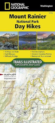
Day Hikes - Waterproof - Tear-Resistant - Topographic Map In 1899, Mount Rainier became the fifth national park and the first to be established after the Forest Reserve Act of 1891 that created the U.S. Forest Service. An active volcano towering 14,410 feet above sea level, Mount Rainier is the tallest and most iconic feature in the state of Washington. From massive glaciers, stunning wildflower-covered subalpine meadows, and large stands of old-growth forests the beauty of this park is undeniable. And, with so many spectacular historical and natural resources, scenic views, and recreational opportunities, Mount Rainier has something for everyone. The Mount Rainier National Park Day Hikes Topographic Map Guide contains detailed maps for 18 of Mount Rainier's finest day hikes. It includes well-known hikes and some off-the-beaten-path trails. They range from easy strolls to strenuous climbs, selected to give you a sampling of all the park has to offer. Together, they cover more than 100 miles of adventures. One-third of the selected hikes are less than 6 miles long, two-thirds are less than 8 miles, and one hike is 13 miles long. Each of the 18 maps include directions to the trailhead, the total distance to complete the hike, and an estimate of the degree of difficulty. Also provided are elevations of key points on the trail, an elevation profile for the hike, and a calculation of the hike's total elevation gain. Concise trail descriptions will help you find the hikes that best suit your interests, conditioning, and available time. Every Trails Illustrated map is printed on "Backcountry Tough" waterproof, tear-resistant paper. A full UTM grid is printed on the map to aid with GPS navigation. Every map purchase helps support the National Geographic Society, an impact driven, nonprofit organization with global reach that uses the power of science, exploration, education, and storytelling to illuminate and protect the wonder of our world.
DELIVERY & RETURNS
UK Delivery:
- Free delivery on all orders of £10 or more.
- £1.49 delivery fee on orders below £10.
- UK orders are shipped via Royal Mail 2nd Class.
International Delivery:
- Flat rate delivery charges vary by country.
Dispatch and Delivery Times:
- All orders are shipped from our warehouse in Northampton, UK within 48 hours of receipt during working hours.
- UK mainland orders typically arrive within 3-5 working days via Royal Mail 2nd Class.
- International estimated delivery times:
- Europe & Channel Islands: 7 to 10 working days
- USA: 7 to 15 working days
- Rest of the World: 9 to 21 working days
View our full delivery infomation here.
-
OVER
2 MILLION PRODUCTS
-
60 MILLION CUSTOMERS
ACROSS 190 COUNTRIES
You might also like
Loading recommendations...