
Fort Myers Beach, Naples Map
Fort Myers Beach, Naples Map
Trails Illustrated Maps
Map
Couldn't load pickup availability
Join our rewards scheme and earn reward points on this purchase!
Earn points on this!
Sign in or Sign up!- Release Date: 26/09/2013
- Barcode: 9781566956765
- Genre: Science Nature & Math
- Sub-Genre: Atlases & Maps
- Imprint: National Geographic
Fort Myers Beach, Naples Map
Standard Edition
Couldn't load pickup availability
Collapsible content
DESCRIPTION
Trails Illustrated Maps
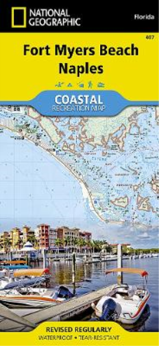
• Waterproof • Tear-Resistant • Topographic MapLet National Geographic's Coastal Recreation map of Fort Myers Beach and Naples lead you both on land and on water, along the shorelines in southwest Florida. This expertly researched map delivers unparalleled detail of recreation hotspots such as Estero Bay Preserve State Park and Aquatic Preserve; Sanibel, Estero and Keewaydin Islands; Lovers Key and Delnor-Wiggins Pass State Parks; Bonita and Naples Beaches; Imperial River; Big and Little Hickory Bays; Barefoot Beach Boulevard; Rookery Bay National Estuarine Research Reserve; J.N. Darling National Wildlife Refuge; and Gulf of Mexico as well as a complete road network from San Carlos Park to the city of Naples. Pursue your recreational passion by following along mapped trails for hiking, biking, kayaking, canoeing or other paddling vessel, including the Great Calusa Blueway and a segment of the Florida Circumnavigational Saltwater Paddling Trail. Other recreation features pinpointed include campgrounds, RV campgrounds, boat launches, beaches, golf courses, dive sites and areas for picnicking, swimming, snorkeling and fishing. A marina guide provides location, contact information, maximum boat sizes and various amenities. Some additional marine aids are day beacons, lights, buoys and sounding. Also provided are QR codes for current weather information and U.S. Coast Guard updates as well as background information of the area, boating safety tips and essential contact information.Every Trails Illustrated map is printed on 'Backcountry Tough' waterproof, tear-resistant paper. A full UTM grid is printed on the map to aid with GPS navigation.Other features found on this map include: Bonita Springs, Estero Bay, Naples.
DELIVERY & RETURNS
UK Delivery:
- Free delivery on all orders of £10 or more.
- £1.49 delivery fee on orders below £10.
- UK orders are shipped via Royal Mail 2nd Class.
International Delivery:
- Flat rate delivery charges vary by country.
Dispatch and Delivery Times:
- All orders are shipped from our warehouse in Northampton, UK within 48 hours of receipt during working hours.
- UK mainland orders typically arrive within 3-5 working days via Royal Mail 2nd Class.
- International estimated delivery times:
- Europe & Channel Islands: 7 to 10 working days
- USA: 7 to 15 working days
- Rest of the World: 9 to 21 working days
View our full delivery infomation here.
-
OVER
2 MILLION PRODUCTS
-
60 MILLION CUSTOMERS
ACROSS 190 COUNTRIES
You might also like
Loading recommendations...